You are here: Home > Network List > IU - Global Seismograph Network (GSN - IRIS/USGS) Stations List
> Station JOHN Johnston Island, USA > Earthquake Result Viewer
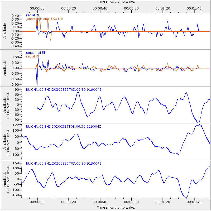
JOHN Johnston Island, USA - Earthquake Result Viewer
*The percent match for this event was below the threshold and hence no stack was calculated.
| Earthquake location: |
Northern California |
| Earthquake latitude/longitude: |
40.3/-122.4 |
| Earthquake time(UTC): |
2020/03/25 (085) 02:58:37 GMT |
| Earthquake Depth: |
65 km |
| Earthquake Magnitude: |
5.4 Mw |
| Earthquake Catalog/Contributor: |
NEIC PDE/nc |
|
| Network: |
IU Global Seismograph Network (GSN - IRIS/USGS) |
| Station: |
JOHN Johnston Island, USA |
| Lat/Lon: |
16.73 N/169.53 W |
| Elevation: |
2.0 m |
|
| Distance: |
46.9 deg |
| Az: |
253.973 deg |
| Baz: |
50.077 deg |
| Ray Param: |
$rayparam |
*The percent match for this event was below the threshold and hence was not used in the summary stack. |
|
| Radial Match: |
49.711063 % |
| Radial Bump: |
400 |
| Transverse Match: |
62.789173 % |
| Transverse Bump: |
400 |
| SOD ConfigId: |
20906531 |
| Insert Time: |
2020-04-08 15:31:18.152 +0000 |
| GWidth: |
2.5 |
| Max Bumps: |
400 |
| Tol: |
0.001 |
|
Signal To Noise
| Channel | StoN | STA | LTA |
| IU:JOHN:00:BHZ:20200325T03:06:30.919004Z | 1.6364043 | 5.220146E-5 | 3.19001E-5 |
| IU:JOHN:00:BH1:20200325T03:06:30.919004Z | 1.734388 | 4.7682704E-5 | 2.7492524E-5 |
| IU:JOHN:00:BH2:20200325T03:06:30.919004Z | 2.176169 | 5.131048E-5 | 2.3578354E-5 |
| Arrivals |
| Ps | |
| PpPs | |
| PsPs/PpSs | |


