You are here: Home > Network List > TA - USArray Transportable Network (new EarthScope stations) Stations List
> Station H16K Elim, AK, USA > Earthquake Result Viewer
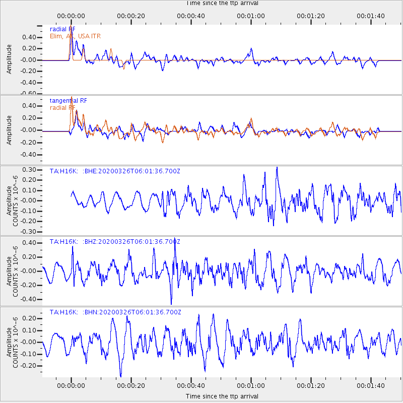
H16K Elim, AK, USA - Earthquake Result Viewer
*The percent match for this event was below the threshold and hence no stack was calculated.
| Earthquake location: |
Volcano Islands, Japan Region |
| Earthquake latitude/longitude: |
22.7/143.2 |
| Earthquake time(UTC): |
2020/03/26 (086) 05:52:48 GMT |
| Earthquake Depth: |
105 km |
| Earthquake Magnitude: |
5.4 Mww |
| Earthquake Catalog/Contributor: |
NEIC PDE/us |
|
| Network: |
TA USArray Transportable Network (new EarthScope stations) |
| Station: |
H16K Elim, AK, USA |
| Lat/Lon: |
64.64 N/162.24 W |
| Elevation: |
216 m |
|
| Distance: |
54.8 deg |
| Az: |
25.444 deg |
| Baz: |
247.09 deg |
| Ray Param: |
$rayparam |
*The percent match for this event was below the threshold and hence was not used in the summary stack. |
|
| Radial Match: |
57.83749 % |
| Radial Bump: |
400 |
| Transverse Match: |
46.265373 % |
| Transverse Bump: |
388 |
| SOD ConfigId: |
20906531 |
| Insert Time: |
2020-04-09 06:05:51.038 +0000 |
| GWidth: |
2.5 |
| Max Bumps: |
400 |
| Tol: |
0.001 |
|
Signal To Noise
| Channel | StoN | STA | LTA |
| TA:H16K: :BHZ:20200326T06:01:36.700Z | 2.4516625 | 1.3731264E-7 | 5.600797E-8 |
| TA:H16K: :BHN:20200326T06:01:36.700Z | 1.2722963 | 6.204724E-8 | 4.876792E-8 |
| TA:H16K: :BHE:20200326T06:01:36.700Z | 1.4250339 | 8.025668E-8 | 5.6319134E-8 |
| Arrivals |
| Ps | |
| PpPs | |
| PsPs/PpSs | |


