You are here: Home > Network List > AV - Alaska Volcano Observatory Stations List
> Station AMKA Regional Station, Amchitka Island, Alaska > Earthquake Result Viewer
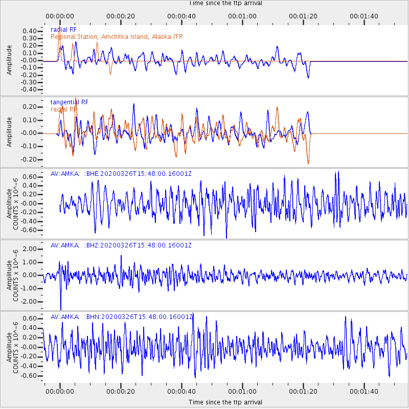
AMKA Regional Station, Amchitka Island, Alaska - Earthquake Result Viewer
*The percent match for this event was below the threshold and hence no stack was calculated.
| Earthquake location: |
Mindanao, Philippines |
| Earthquake latitude/longitude: |
5.6/125.1 |
| Earthquake time(UTC): |
2020/03/26 (086) 15:38:04 GMT |
| Earthquake Depth: |
59 km |
| Earthquake Magnitude: |
6.1 mww |
| Earthquake Catalog/Contributor: |
NEIC PDE/us |
|
| Network: |
AV Alaska Volcano Observatory |
| Station: |
AMKA Regional Station, Amchitka Island, Alaska |
| Lat/Lon: |
51.38 N/179.30 E |
| Elevation: |
116 m |
|
| Distance: |
63.9 deg |
| Az: |
34.493 deg |
| Baz: |
244.075 deg |
| Ray Param: |
$rayparam |
*The percent match for this event was below the threshold and hence was not used in the summary stack. |
|
| Radial Match: |
48.58289 % |
| Radial Bump: |
400 |
| Transverse Match: |
53.73634 % |
| Transverse Bump: |
400 |
| SOD ConfigId: |
20906531 |
| Insert Time: |
2020-04-09 15:42:04.640 +0000 |
| GWidth: |
2.5 |
| Max Bumps: |
400 |
| Tol: |
0.001 |
|
Signal To Noise
| Channel | StoN | STA | LTA |
| AV:AMKA: :BHZ:20200326T15:48:00.16001Z | 3.4232538 | 7.1001193E-7 | 2.0740849E-7 |
| AV:AMKA: :BHN:20200326T15:48:00.16001Z | 1.4738753 | 2.2936044E-7 | 1.5561727E-7 |
| AV:AMKA: :BHE:20200326T15:48:00.16001Z | 1.0169414 | 2.1838957E-7 | 2.1475137E-7 |
| Arrivals |
| Ps | |
| PpPs | |
| PsPs/PpSs | |


