You are here: Home > Network List > G - GEOSCOPE Stations List
> Station PPTF Pamatai - Papeete - Tahiti island - French Polynesia, France > Earthquake Result Viewer
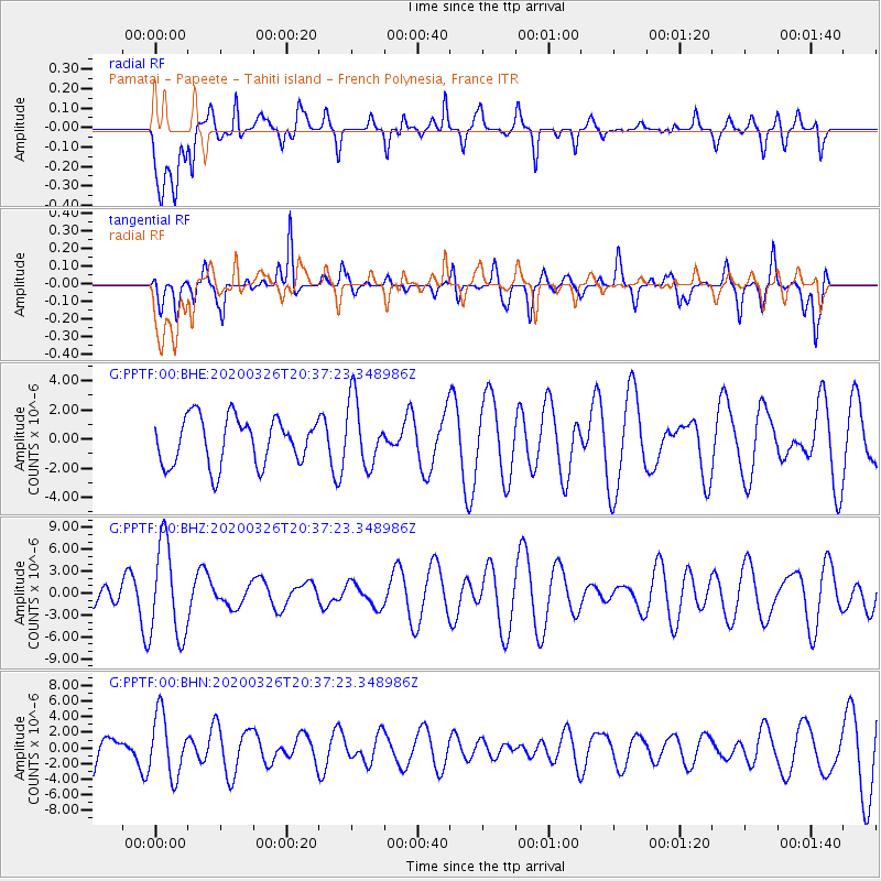
PPTF Pamatai - Papeete - Tahiti island - French Polynesia, France - Earthquake Result Viewer
*The percent match for this event was below the threshold and hence no stack was calculated.
| Earthquake location: |
South Sandwich Islands Region |
| Earthquake latitude/longitude: |
-56.6/-26.9 |
| Earthquake time(UTC): |
2020/03/26 (086) 20:24:54 GMT |
| Earthquake Depth: |
78 km |
| Earthquake Magnitude: |
5.4 Mww |
| Earthquake Catalog/Contributor: |
NEIC PDE/us |
|
| Network: |
G GEOSCOPE |
| Station: |
PPTF Pamatai - Papeete - Tahiti island - French Polynesia, France |
| Lat/Lon: |
17.59 S/149.57 W |
| Elevation: |
705 m |
|
| Distance: |
92.0 deg |
| Az: |
233.454 deg |
| Baz: |
152.241 deg |
| Ray Param: |
$rayparam |
*The percent match for this event was below the threshold and hence was not used in the summary stack. |
|
| Radial Match: |
52.53766 % |
| Radial Bump: |
400 |
| Transverse Match: |
56.348774 % |
| Transverse Bump: |
400 |
| SOD ConfigId: |
20906531 |
| Insert Time: |
2020-04-09 20:27:10.952 +0000 |
| GWidth: |
2.5 |
| Max Bumps: |
400 |
| Tol: |
0.001 |
|
Signal To Noise
| Channel | StoN | STA | LTA |
| G:PPTF:00:BHZ:20200326T20:37:23.348986Z | 3.903019 | 6.3979855E-6 | 1.6392402E-6 |
| G:PPTF:00:BHN:20200326T20:37:23.348986Z | 2.0847065 | 3.8887906E-6 | 1.8653899E-6 |
| G:PPTF:00:BHE:20200326T20:37:23.348986Z | 1.40149 | 2.2702318E-6 | 1.6198702E-6 |
| Arrivals |
| Ps | |
| PpPs | |
| PsPs/PpSs | |


