You are here: Home > Network List > AV - Alaska Volcano Observatory Stations List
> Station SPCR Ckakachatna River, Mount Spurr, Alaska > Earthquake Result Viewer
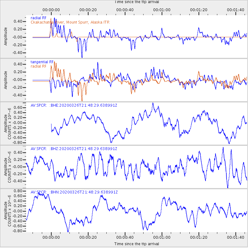
SPCR Ckakachatna River, Mount Spurr, Alaska - Earthquake Result Viewer
*The percent match for this event was below the threshold and hence no stack was calculated.
| Earthquake location: |
Near North Coast Of Irian Jaya |
| Earthquake latitude/longitude: |
-3.0/139.1 |
| Earthquake time(UTC): |
2020/03/26 (086) 21:36:42 GMT |
| Earthquake Depth: |
38 km |
| Earthquake Magnitude: |
5.7 mww |
| Earthquake Catalog/Contributor: |
NEIC PDE/us |
|
| Network: |
AV Alaska Volcano Observatory |
| Station: |
SPCR Ckakachatna River, Mount Spurr, Alaska |
| Lat/Lon: |
61.20 N/152.21 W |
| Elevation: |
984 m |
|
| Distance: |
82.5 deg |
| Az: |
27.066 deg |
| Baz: |
249.79 deg |
| Ray Param: |
$rayparam |
*The percent match for this event was below the threshold and hence was not used in the summary stack. |
|
| Radial Match: |
55.630627 % |
| Radial Bump: |
400 |
| Transverse Match: |
53.586597 % |
| Transverse Bump: |
400 |
| SOD ConfigId: |
20906531 |
| Insert Time: |
2020-04-09 21:39:01.173 +0000 |
| GWidth: |
2.5 |
| Max Bumps: |
400 |
| Tol: |
0.001 |
|
Signal To Noise
| Channel | StoN | STA | LTA |
| AV:SPCR: :BHZ:20200326T21:48:29.638991Z | 1.8349371 | 2.296604E-7 | 1.2515981E-7 |
| AV:SPCR: :BHN:20200326T21:48:29.638991Z | 0.6327578 | 2.2361266E-7 | 3.5339377E-7 |
| AV:SPCR: :BHE:20200326T21:48:29.638991Z | 2.5424175 | 5.9436485E-7 | 2.337794E-7 |
| Arrivals |
| Ps | |
| PpPs | |
| PsPs/PpSs | |


