You are here: Home > Network List > TA - USArray Transportable Network (new EarthScope stations) Stations List
> Station H31M Peel River, Yukon, CAN > Earthquake Result Viewer
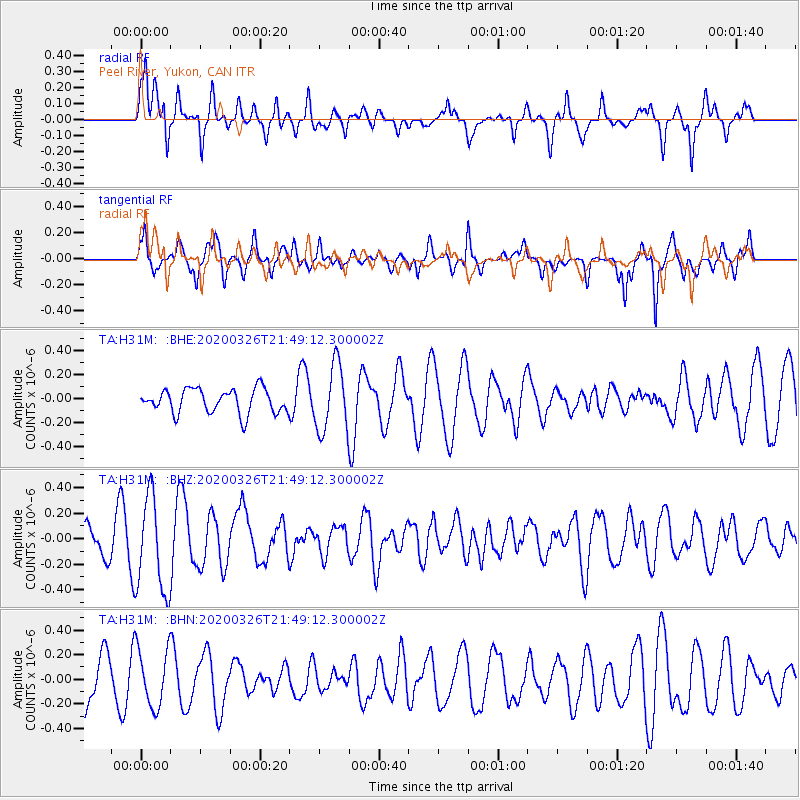
H31M Peel River, Yukon, CAN - Earthquake Result Viewer
*The percent match for this event was below the threshold and hence no stack was calculated.
| Earthquake location: |
Near North Coast Of Irian Jaya |
| Earthquake latitude/longitude: |
-3.0/139.1 |
| Earthquake time(UTC): |
2020/03/26 (086) 21:36:42 GMT |
| Earthquake Depth: |
38 km |
| Earthquake Magnitude: |
5.7 mww |
| Earthquake Catalog/Contributor: |
NEIC PDE/us |
|
| Network: |
TA USArray Transportable Network (new EarthScope stations) |
| Station: |
H31M Peel River, Yukon, CAN |
| Lat/Lon: |
65.81 N/134.34 W |
| Elevation: |
642 m |
|
| Distance: |
91.2 deg |
| Az: |
24.298 deg |
| Baz: |
265.645 deg |
| Ray Param: |
$rayparam |
*The percent match for this event was below the threshold and hence was not used in the summary stack. |
|
| Radial Match: |
76.940834 % |
| Radial Bump: |
400 |
| Transverse Match: |
63.331413 % |
| Transverse Bump: |
400 |
| SOD ConfigId: |
20906531 |
| Insert Time: |
2020-04-09 21:43:41.631 +0000 |
| GWidth: |
2.5 |
| Max Bumps: |
400 |
| Tol: |
0.001 |
|
Signal To Noise
| Channel | StoN | STA | LTA |
| TA:H31M: :BHZ:20200326T21:49:12.300002Z | 2.5880551 | 3.7543654E-7 | 1.4506513E-7 |
| TA:H31M: :BHN:20200326T21:49:12.300002Z | 1.1031727 | 2.3618608E-7 | 2.140971E-7 |
| TA:H31M: :BHE:20200326T21:49:12.300002Z | 2.7493854 | 2.7797498E-7 | 1.0110441E-7 |
| Arrivals |
| Ps | |
| PpPs | |
| PsPs/PpSs | |


