You are here: Home > Network List > TA - USArray Transportable Network (new EarthScope stations) Stations List
> Station R31K City Hall, Gustavus, AK, USA > Earthquake Result Viewer
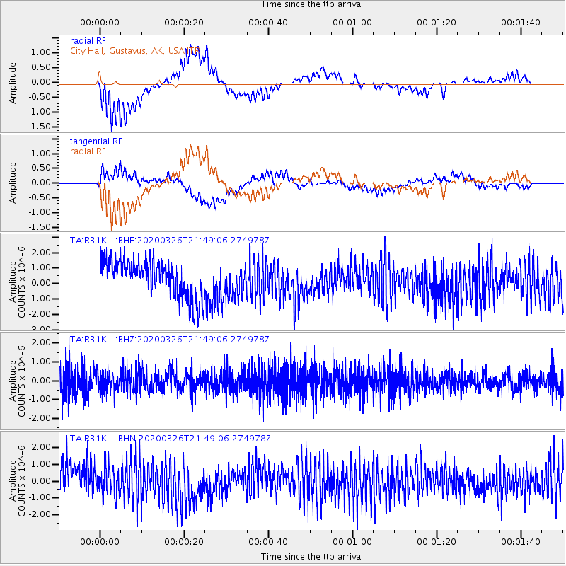
R31K City Hall, Gustavus, AK, USA - Earthquake Result Viewer
*The percent match for this event was below the threshold and hence no stack was calculated.
| Earthquake location: |
Near North Coast Of Irian Jaya |
| Earthquake latitude/longitude: |
-3.0/139.1 |
| Earthquake time(UTC): |
2020/03/26 (086) 21:36:42 GMT |
| Earthquake Depth: |
38 km |
| Earthquake Magnitude: |
5.7 mww |
| Earthquake Catalog/Contributor: |
NEIC PDE/us |
|
| Network: |
TA USArray Transportable Network (new EarthScope stations) |
| Station: |
R31K City Hall, Gustavus, AK, USA |
| Lat/Lon: |
58.41 N/135.74 W |
| Elevation: |
15 m |
|
| Distance: |
89.9 deg |
| Az: |
31.632 deg |
| Baz: |
264.333 deg |
| Ray Param: |
$rayparam |
*The percent match for this event was below the threshold and hence was not used in the summary stack. |
|
| Radial Match: |
26.451 % |
| Radial Bump: |
400 |
| Transverse Match: |
26.816822 % |
| Transverse Bump: |
400 |
| SOD ConfigId: |
20906531 |
| Insert Time: |
2020-04-09 21:44:13.820 +0000 |
| GWidth: |
2.5 |
| Max Bumps: |
400 |
| Tol: |
0.001 |
|
Signal To Noise
| Channel | StoN | STA | LTA |
| TA:R31K: :BHZ:20200326T21:49:06.274978Z | 0.6868876 | 4.619759E-7 | 6.7256406E-7 |
| TA:R31K: :BHN:20200326T21:49:06.274978Z | 0.9061179 | 7.727101E-7 | 8.527699E-7 |
| TA:R31K: :BHE:20200326T21:49:06.274978Z | 0.96300924 | 1.1125196E-6 | 1.1552534E-6 |
| Arrivals |
| Ps | |
| PpPs | |
| PsPs/PpSs | |


