You are here: Home > Network List > GT - Global Telemetered Seismograph Network (USAF/USGS) Stations List
> Station LPAZ La Paz , Bolivia > Earthquake Result Viewer
LPAZ La Paz , Bolivia - Earthquake Result Viewer

| Earthquake location: |
South Sandwich Islands Region |
| Earthquake latitude/longitude: |
-56.4/-25.7 |
| Earthquake time(UTC): |
2017/05/11 (131) 01:09:42 GMT |
| Earthquake Depth: |
10 km |
| Earthquake Magnitude: |
5.6 mb |
| Earthquake Catalog/Contributor: |
NEIC PDE/us |
|
| Network: |
GT Global Telemetered Seismograph Network (USAF/USGS) |
| Station: |
LPAZ La Paz , Bolivia |
| Lat/Lon: |
16.17 S/68.08 W |
| Elevation: |
4817 m |
|
| Distance: |
51.3 deg |
| Az: |
304.0 deg |
| Baz: |
151.341 deg |
| Ray Param: |
0.06748718 |
| Estimated Moho Depth: |
49.25 km |
| Estimated Crust Vp/Vs: |
1.94 |
| Assumed Crust Vp: |
6.454 km/s |
| Estimated Crust Vs: |
3.327 km/s |
| Estimated Crust Poisson's Ratio: |
0.32 |
|
| Radial Match: |
84.925 % |
| Radial Bump: |
400 |
| Transverse Match: |
76.704926 % |
| Transverse Bump: |
400 |
| SOD ConfigId: |
2028011 |
| Insert Time: |
2017-05-25 01:11:30.319 +0000 |
| GWidth: |
2.5 |
| Max Bumps: |
400 |
| Tol: |
0.001 |
|
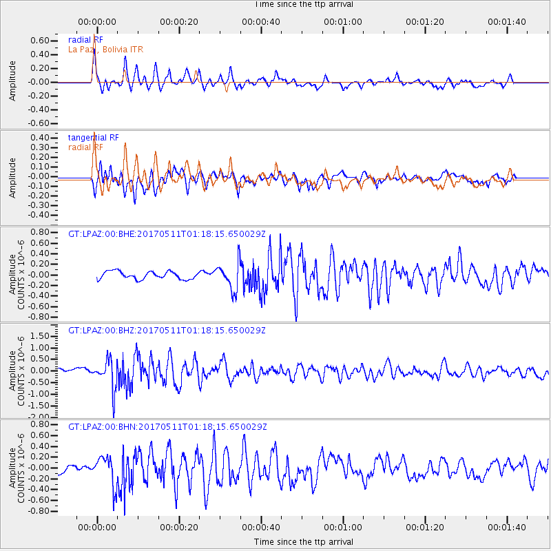
Signal To Noise
| Channel | StoN | STA | LTA |
| GT:LPAZ:00:BHZ:20170511T01:18:15.650029Z | 5.50648 | 6.4607997E-7 | 1.1733084E-7 |
| GT:LPAZ:00:BHN:20170511T01:18:15.650029Z | 4.1778874 | 2.7813306E-7 | 6.657266E-8 |
| GT:LPAZ:00:BHE:20170511T01:18:15.650029Z | 3.8411553 | 2.747535E-7 | 7.1528866E-8 |
| Arrivals |
| Ps | 7.6 SECOND |
| PpPs | 21 SECOND |
| PsPs/PpSs | 29 SECOND |


