You are here: Home > Network List > CI - Caltech Regional Seismic Network Stations List
> Station MPM Manuel Prospect Mine, California, USA > Earthquake Result Viewer
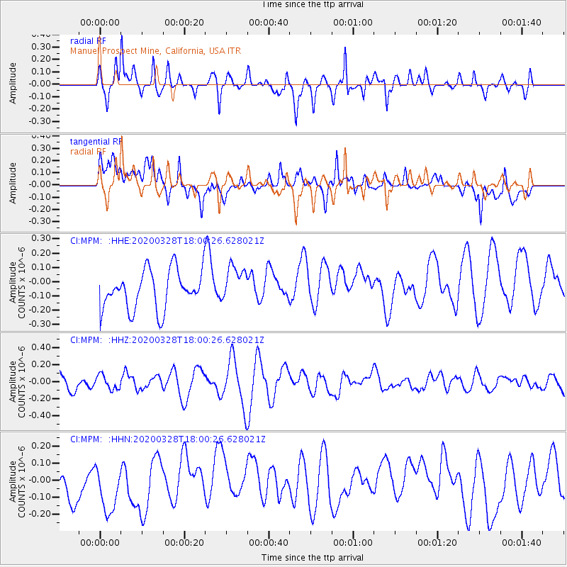
MPM Manuel Prospect Mine, California, USA - Earthquake Result Viewer
*The percent match for this event was below the threshold and hence no stack was calculated.
| Earthquake location: |
Vanuatu Islands |
| Earthquake latitude/longitude: |
-17.8/168.3 |
| Earthquake time(UTC): |
2020/03/28 (088) 17:48:16 GMT |
| Earthquake Depth: |
84 km |
| Earthquake Magnitude: |
5.8 mww |
| Earthquake Catalog/Contributor: |
NEIC PDE/us |
|
| Network: |
CI Caltech Regional Seismic Network |
| Station: |
MPM Manuel Prospect Mine, California, USA |
| Lat/Lon: |
36.06 N/117.49 W |
| Elevation: |
185 m |
|
| Distance: |
88.2 deg |
| Az: |
51.274 deg |
| Baz: |
246.545 deg |
| Ray Param: |
$rayparam |
*The percent match for this event was below the threshold and hence was not used in the summary stack. |
|
| Radial Match: |
59.731903 % |
| Radial Bump: |
400 |
| Transverse Match: |
47.433926 % |
| Transverse Bump: |
400 |
| SOD ConfigId: |
20906531 |
| Insert Time: |
2020-04-11 17:52:31.054 +0000 |
| GWidth: |
2.5 |
| Max Bumps: |
400 |
| Tol: |
0.001 |
|
Signal To Noise
| Channel | StoN | STA | LTA |
| CI:MPM: :HHZ:20200328T18:00:26.628021Z | 0.44864336 | 8.415321E-8 | 1.8757262E-7 |
| CI:MPM: :HHN:20200328T18:00:26.628021Z | 1.3425612 | 1.9193459E-7 | 1.4296151E-7 |
| CI:MPM: :HHE:20200328T18:00:26.628021Z | 0.9758719 | 1.3188298E-7 | 1.3514374E-7 |
| Arrivals |
| Ps | |
| PpPs | |
| PsPs/PpSs | |


