You are here: Home > Network List > GS - US Geological Survey Networks Stations List
> Station DEC05 Decatur Surface Seismic Site, Decatur, IL, USA > Earthquake Result Viewer
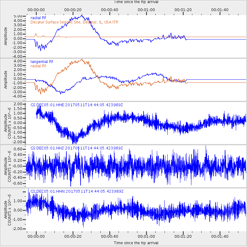
DEC05 Decatur Surface Seismic Site, Decatur, IL, USA - Earthquake Result Viewer
*The percent match for this event was below the threshold and hence no stack was calculated.
| Earthquake location: |
Kodiak Island Region, Alaska |
| Earthquake latitude/longitude: |
56.8/-152.5 |
| Earthquake time(UTC): |
2017/05/11 (131) 14:36:30 GMT |
| Earthquake Depth: |
14 km |
| Earthquake Magnitude: |
5.5 Ml |
| Earthquake Catalog/Contributor: |
NEIC PDE/ak |
|
| Network: |
GS US Geological Survey Networks |
| Station: |
DEC05 Decatur Surface Seismic Site, Decatur, IL, USA |
| Lat/Lon: |
39.87 N/88.87 W |
| Elevation: |
216 m |
|
| Distance: |
43.9 deg |
| Az: |
84.547 deg |
| Baz: |
314.67 deg |
| Ray Param: |
$rayparam |
*The percent match for this event was below the threshold and hence was not used in the summary stack. |
|
| Radial Match: |
58.340084 % |
| Radial Bump: |
400 |
| Transverse Match: |
42.928905 % |
| Transverse Bump: |
400 |
| SOD ConfigId: |
2028011 |
| Insert Time: |
2017-05-25 14:37:59.323 +0000 |
| GWidth: |
2.5 |
| Max Bumps: |
400 |
| Tol: |
0.001 |
|
Signal To Noise
| Channel | StoN | STA | LTA |
| GS:DEC05:01:HHZ:20170511T14:44:05.423989Z | 1.0738951 | 1.9760905E-7 | 1.8401153E-7 |
| GS:DEC05:01:HHN:20170511T14:44:05.423989Z | 2.1204636 | 1.78276E-6 | 8.407407E-7 |
| GS:DEC05:01:HHE:20170511T14:44:05.423989Z | 0.3156277 | 3.2981023E-7 | 1.0449344E-6 |
| Arrivals |
| Ps | |
| PpPs | |
| PsPs/PpSs | |


