You are here: Home > Network List > GS - US Geological Survey Networks Stations List
> Station KAN13 Rinehart Farm > Earthquake Result Viewer
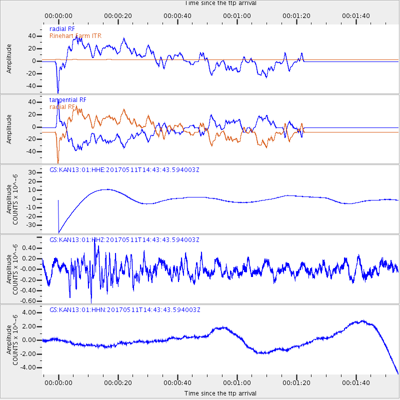
KAN13 Rinehart Farm - Earthquake Result Viewer
*The percent match for this event was below the threshold and hence no stack was calculated.
| Earthquake location: |
Kodiak Island Region, Alaska |
| Earthquake latitude/longitude: |
56.8/-152.5 |
| Earthquake time(UTC): |
2017/05/11 (131) 14:36:30 GMT |
| Earthquake Depth: |
14 km |
| Earthquake Magnitude: |
5.5 Ml |
| Earthquake Catalog/Contributor: |
NEIC PDE/ak |
|
| Network: |
GS US Geological Survey Networks |
| Station: |
KAN13 Rinehart Farm |
| Lat/Lon: |
37.01 N/97.48 W |
| Elevation: |
340 m |
|
| Distance: |
41.2 deg |
| Az: |
94.657 deg |
| Baz: |
316.794 deg |
| Ray Param: |
$rayparam |
*The percent match for this event was below the threshold and hence was not used in the summary stack. |
|
| Radial Match: |
42.328236 % |
| Radial Bump: |
400 |
| Transverse Match: |
45.33682 % |
| Transverse Bump: |
400 |
| SOD ConfigId: |
2028011 |
| Insert Time: |
2017-05-25 14:38:08.368 +0000 |
| GWidth: |
2.5 |
| Max Bumps: |
400 |
| Tol: |
0.001 |
|
Signal To Noise
| Channel | StoN | STA | LTA |
| GS:KAN13:01:HHZ:20170511T14:43:43.594003Z | 1.299494 | 1.5435266E-7 | 1.1877904E-7 |
| GS:KAN13:01:HHN:20170511T14:43:43.594003Z | 0.66176224 | 4.696795E-7 | 7.0974056E-7 |
| GS:KAN13:01:HHE:20170511T14:43:43.594003Z | 0.21515933 | 3.0409064E-6 | 1.4133278E-5 |
| Arrivals |
| Ps | |
| PpPs | |
| PsPs/PpSs | |


