You are here: Home > Network List > GS - US Geological Survey Networks Stations List
> Station OK031 S. Brethren Rd., Cushing, OK, USA > Earthquake Result Viewer
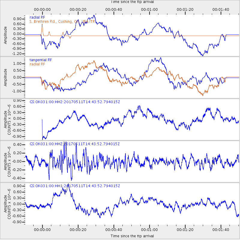
OK031 S. Brethren Rd., Cushing, OK, USA - Earthquake Result Viewer
*The percent match for this event was below the threshold and hence no stack was calculated.
| Earthquake location: |
Kodiak Island Region, Alaska |
| Earthquake latitude/longitude: |
56.8/-152.5 |
| Earthquake time(UTC): |
2017/05/11 (131) 14:36:30 GMT |
| Earthquake Depth: |
14 km |
| Earthquake Magnitude: |
5.5 Ml |
| Earthquake Catalog/Contributor: |
NEIC PDE/ak |
|
| Network: |
GS US Geological Survey Networks |
| Station: |
OK031 S. Brethren Rd., Cushing, OK, USA |
| Lat/Lon: |
35.95 N/96.84 W |
| Elevation: |
290 m |
|
| Distance: |
42.3 deg |
| Az: |
95.17 deg |
| Baz: |
317.555 deg |
| Ray Param: |
$rayparam |
*The percent match for this event was below the threshold and hence was not used in the summary stack. |
|
| Radial Match: |
46.62515 % |
| Radial Bump: |
400 |
| Transverse Match: |
40.998947 % |
| Transverse Bump: |
400 |
| SOD ConfigId: |
2028011 |
| Insert Time: |
2017-05-25 14:38:25.146 +0000 |
| GWidth: |
2.5 |
| Max Bumps: |
400 |
| Tol: |
0.001 |
|
Signal To Noise
| Channel | StoN | STA | LTA |
| GS:OK031:00:HHZ:20170511T14:43:52.794015Z | 1.9464463 | 1.3721007E-7 | 7.0492604E-8 |
| GS:OK031:00:HH1:20170511T14:43:52.794015Z | 1.0142148 | 3.6124152E-7 | 3.5617853E-7 |
| GS:OK031:00:HH2:20170511T14:43:52.794015Z | 0.49547276 | 1.8932957E-7 | 3.8211903E-7 |
| Arrivals |
| Ps | |
| PpPs | |
| PsPs/PpSs | |


