You are here: Home > Network List > CI - Caltech Regional Seismic Network Stations List
> Station MPM Manuel Prospect Mine, California, USA > Earthquake Result Viewer
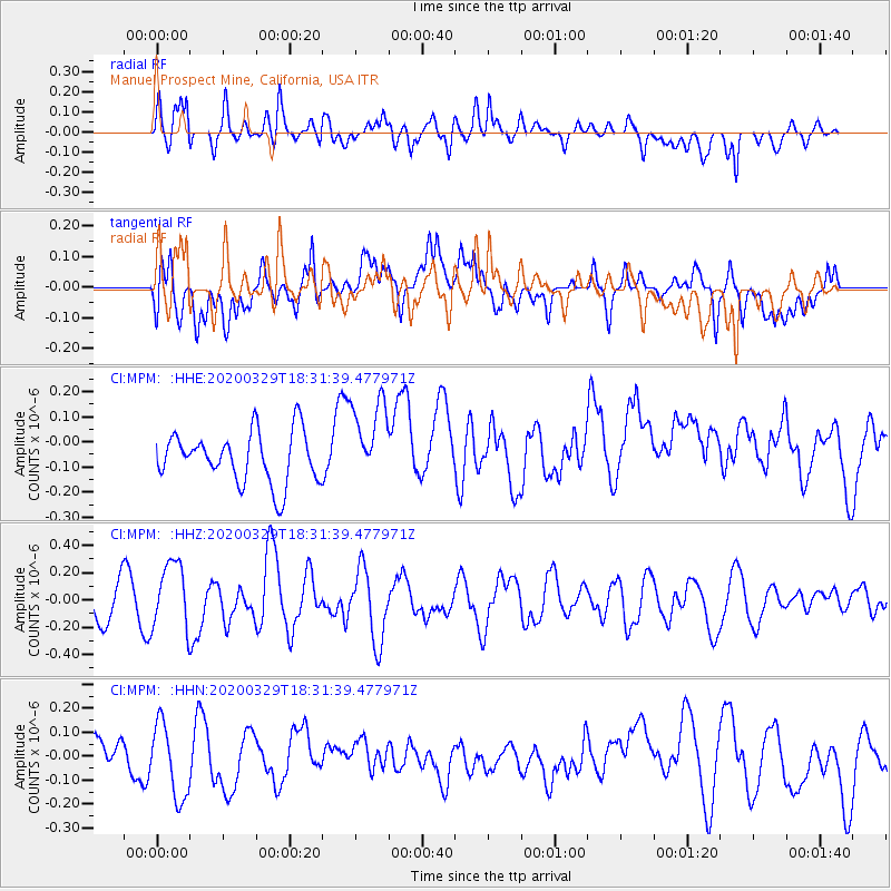
MPM Manuel Prospect Mine, California, USA - Earthquake Result Viewer
*The percent match for this event was below the threshold and hence no stack was calculated.
| Earthquake location: |
Southeast Of Loyalty Islands |
| Earthquake latitude/longitude: |
-21.4/169.5 |
| Earthquake time(UTC): |
2020/03/29 (089) 18:19:13 GMT |
| Earthquake Depth: |
10 km |
| Earthquake Magnitude: |
5.6 mww |
| Earthquake Catalog/Contributor: |
NEIC PDE/us |
|
| Network: |
CI Caltech Regional Seismic Network |
| Station: |
MPM Manuel Prospect Mine, California, USA |
| Lat/Lon: |
36.06 N/117.49 W |
| Elevation: |
185 m |
|
| Distance: |
89.6 deg |
| Az: |
50.816 deg |
| Baz: |
243.063 deg |
| Ray Param: |
$rayparam |
*The percent match for this event was below the threshold and hence was not used in the summary stack. |
|
| Radial Match: |
59.6836 % |
| Radial Bump: |
400 |
| Transverse Match: |
52.421467 % |
| Transverse Bump: |
400 |
| SOD ConfigId: |
20906531 |
| Insert Time: |
2020-04-12 18:23:59.602 +0000 |
| GWidth: |
2.5 |
| Max Bumps: |
400 |
| Tol: |
0.001 |
|
Signal To Noise
| Channel | StoN | STA | LTA |
| CI:MPM: :HHZ:20200329T18:31:39.477971Z | 2.058626 | 2.448636E-7 | 1.1894517E-7 |
| CI:MPM: :HHN:20200329T18:31:39.477971Z | 1.7797552 | 1.5532261E-7 | 8.727189E-8 |
| CI:MPM: :HHE:20200329T18:31:39.477971Z | 1.6676811 | 1.6741639E-7 | 1.0038873E-7 |
| Arrivals |
| Ps | |
| PpPs | |
| PsPs/PpSs | |


