You are here: Home > Network List > IU - Global Seismograph Network (GSN - IRIS/USGS) Stations List
> Station JOHN Johnston Island, USA > Earthquake Result Viewer
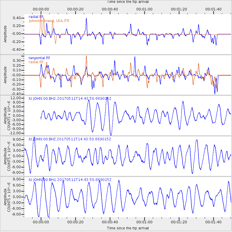
JOHN Johnston Island, USA - Earthquake Result Viewer
*The percent match for this event was below the threshold and hence no stack was calculated.
| Earthquake location: |
Kodiak Island Region, Alaska |
| Earthquake latitude/longitude: |
56.8/-152.5 |
| Earthquake time(UTC): |
2017/05/11 (131) 14:36:30 GMT |
| Earthquake Depth: |
14 km |
| Earthquake Magnitude: |
5.5 Ml |
| Earthquake Catalog/Contributor: |
NEIC PDE/ak |
|
| Network: |
IU Global Seismograph Network (GSN - IRIS/USGS) |
| Station: |
JOHN Johnston Island, USA |
| Lat/Lon: |
16.73 N/169.53 W |
| Elevation: |
2.0 m |
|
| Distance: |
42.0 deg |
| Az: |
204.738 deg |
| Baz: |
13.894 deg |
| Ray Param: |
$rayparam |
*The percent match for this event was below the threshold and hence was not used in the summary stack. |
|
| Radial Match: |
51.76394 % |
| Radial Bump: |
243 |
| Transverse Match: |
50.05728 % |
| Transverse Bump: |
400 |
| SOD ConfigId: |
2028011 |
| Insert Time: |
2017-05-25 14:38:57.169 +0000 |
| GWidth: |
2.5 |
| Max Bumps: |
400 |
| Tol: |
0.001 |
|
Signal To Noise
| Channel | StoN | STA | LTA |
| IU:JOHN:00:BHZ:20170511T14:43:50.669015Z | 1.301438 | 3.5266305E-6 | 2.7097951E-6 |
| IU:JOHN:00:BH1:20170511T14:43:50.669015Z | 1.9949656 | 7.049769E-6 | 3.5337798E-6 |
| IU:JOHN:00:BH2:20170511T14:43:50.669015Z | 3.4507194 | 6.793936E-6 | 1.9688462E-6 |
| Arrivals |
| Ps | |
| PpPs | |
| PsPs/PpSs | |


