You are here: Home > Network List > IU - Global Seismograph Network (GSN - IRIS/USGS) Stations List
> Station RSSD Black Hills, South Dakota, USA > Earthquake Result Viewer
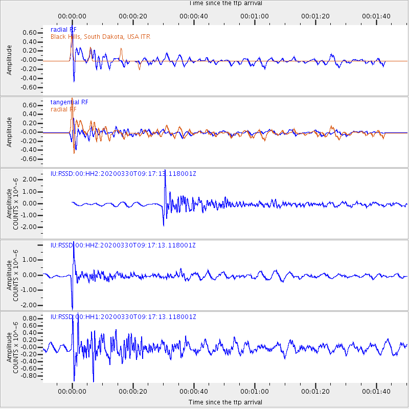
RSSD Black Hills, South Dakota, USA - Earthquake Result Viewer
*The percent match for this event was below the threshold and hence no stack was calculated.
| Earthquake location: |
Colombia-Ecuador Border Region |
| Earthquake latitude/longitude: |
0.3/-77.7 |
| Earthquake time(UTC): |
2020/03/30 (090) 09:09:05 GMT |
| Earthquake Depth: |
128 km |
| Earthquake Magnitude: |
5.2 Mww |
| Earthquake Catalog/Contributor: |
NEIC PDE/us |
|
| Network: |
IU Global Seismograph Network (GSN - IRIS/USGS) |
| Station: |
RSSD Black Hills, South Dakota, USA |
| Lat/Lon: |
44.12 N/104.04 W |
| Elevation: |
2090 m |
|
| Distance: |
49.5 deg |
| Az: |
335.155 deg |
| Baz: |
144.311 deg |
| Ray Param: |
$rayparam |
*The percent match for this event was below the threshold and hence was not used in the summary stack. |
|
| Radial Match: |
56.817024 % |
| Radial Bump: |
400 |
| Transverse Match: |
46.00847 % |
| Transverse Bump: |
400 |
| SOD ConfigId: |
20906531 |
| Insert Time: |
2020-04-13 09:19:16.262 +0000 |
| GWidth: |
2.5 |
| Max Bumps: |
400 |
| Tol: |
0.001 |
|
Signal To Noise
| Channel | StoN | STA | LTA |
| IU:RSSD:00:HHZ:20200330T09:17:13.118001Z | 5.737357 | 7.2567343E-7 | 1.2648218E-7 |
| IU:RSSD:00:HH1:20200330T09:17:13.118001Z | 5.189675 | 3.7758704E-7 | 7.2757366E-8 |
| IU:RSSD:00:HH2:20200330T09:17:13.118001Z | 7.592526 | 8.541114E-7 | 1.12493716E-7 |
| Arrivals |
| Ps | |
| PpPs | |
| PsPs/PpSs | |


