You are here: Home > Network List > TA - USArray Transportable Network (new EarthScope stations) Stations List
> Station R31K City Hall, Gustavus, AK, USA > Earthquake Result Viewer
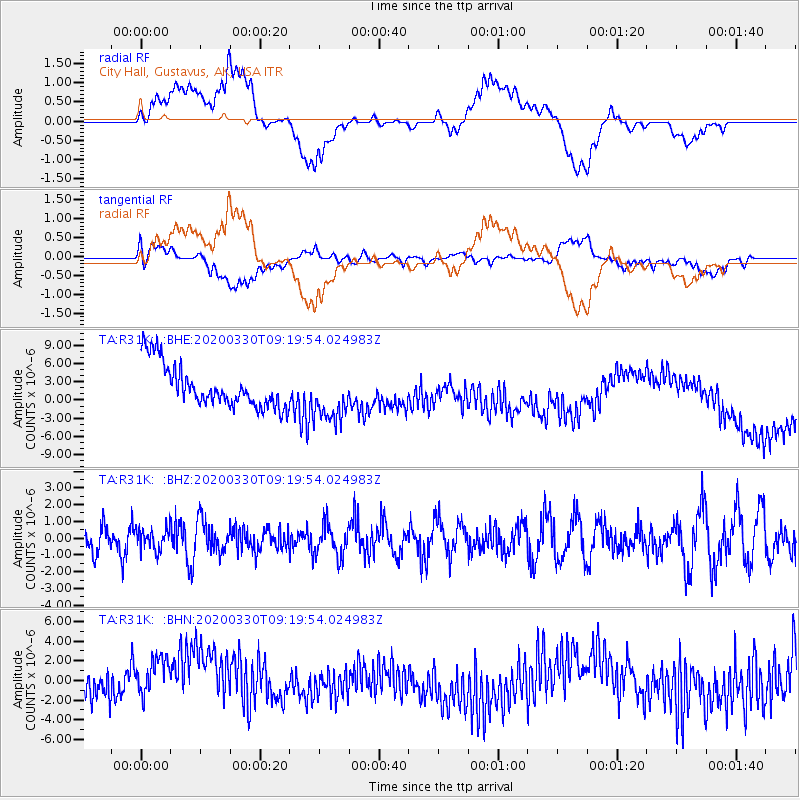
R31K City Hall, Gustavus, AK, USA - Earthquake Result Viewer
*The percent match for this event was below the threshold and hence no stack was calculated.
| Earthquake location: |
Colombia-Ecuador Border Region |
| Earthquake latitude/longitude: |
0.3/-77.7 |
| Earthquake time(UTC): |
2020/03/30 (090) 09:09:05 GMT |
| Earthquake Depth: |
128 km |
| Earthquake Magnitude: |
5.2 Mww |
| Earthquake Catalog/Contributor: |
NEIC PDE/us |
|
| Network: |
TA USArray Transportable Network (new EarthScope stations) |
| Station: |
R31K City Hall, Gustavus, AK, USA |
| Lat/Lon: |
58.41 N/135.74 W |
| Elevation: |
15 m |
|
| Distance: |
73.6 deg |
| Az: |
332.248 deg |
| Baz: |
117.788 deg |
| Ray Param: |
$rayparam |
*The percent match for this event was below the threshold and hence was not used in the summary stack. |
|
| Radial Match: |
31.256569 % |
| Radial Bump: |
400 |
| Transverse Match: |
43.395374 % |
| Transverse Bump: |
400 |
| SOD ConfigId: |
20906531 |
| Insert Time: |
2020-04-13 09:27:20.521 +0000 |
| GWidth: |
2.5 |
| Max Bumps: |
400 |
| Tol: |
0.001 |
|
Signal To Noise
| Channel | StoN | STA | LTA |
| TA:R31K: :BHZ:20200330T09:19:54.024983Z | 0.7577753 | 6.536495E-7 | 8.625902E-7 |
| TA:R31K: :BHN:20200330T09:19:54.024983Z | 1.2897426 | 2.549935E-6 | 1.9770885E-6 |
| TA:R31K: :BHE:20200330T09:19:54.024983Z | 1.2429701 | 4.3624837E-6 | 3.5097255E-6 |
| Arrivals |
| Ps | |
| PpPs | |
| PsPs/PpSs | |


