You are here: Home > Network List > G - GEOSCOPE Stations List
> Station MPG Montagne des Peres, French Guyana > Earthquake Result Viewer
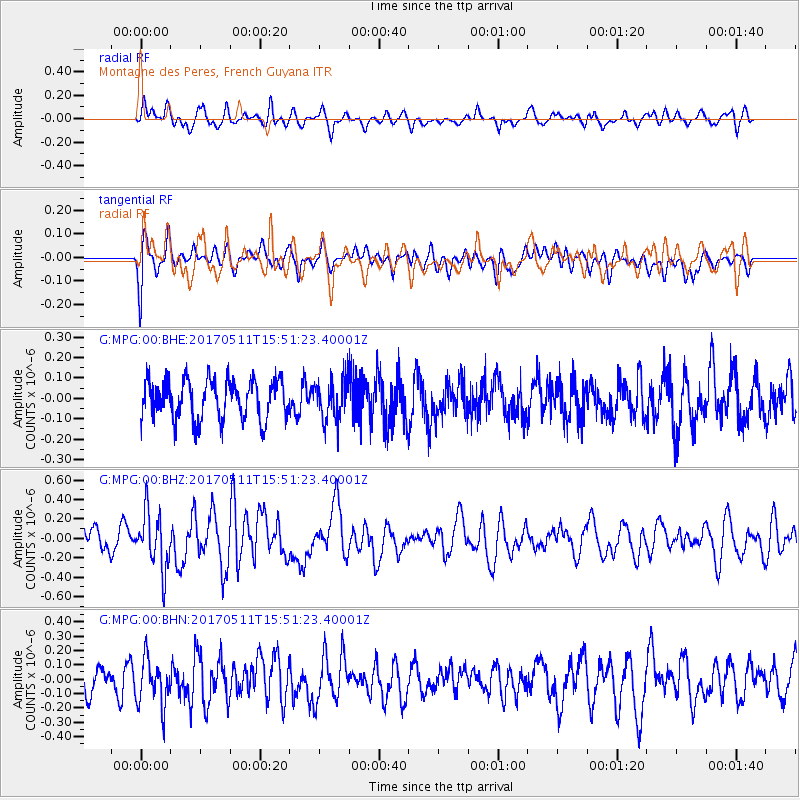
MPG Montagne des Peres, French Guyana - Earthquake Result Viewer
*The percent match for this event was below the threshold and hence no stack was calculated.
| Earthquake location: |
South Sandwich Islands Region |
| Earthquake latitude/longitude: |
-56.6/-26.0 |
| Earthquake time(UTC): |
2017/05/11 (131) 15:41:16 GMT |
| Earthquake Depth: |
35 km |
| Earthquake Magnitude: |
5.6 mb |
| Earthquake Catalog/Contributor: |
NEIC PDE/us |
|
| Network: |
G GEOSCOPE |
| Station: |
MPG Montagne des Peres, French Guyana |
| Lat/Lon: |
5.11 N/52.64 W |
| Elevation: |
147 m |
|
| Distance: |
65.2 deg |
| Az: |
330.528 deg |
| Baz: |
164.144 deg |
| Ray Param: |
$rayparam |
*The percent match for this event was below the threshold and hence was not used in the summary stack. |
|
| Radial Match: |
61.024303 % |
| Radial Bump: |
400 |
| Transverse Match: |
55.022163 % |
| Transverse Bump: |
400 |
| SOD ConfigId: |
2028011 |
| Insert Time: |
2017-05-25 15:47:25.196 +0000 |
| GWidth: |
2.5 |
| Max Bumps: |
400 |
| Tol: |
0.001 |
|
Signal To Noise
| Channel | StoN | STA | LTA |
| G:MPG:00:BHZ:20170511T15:51:23.40001Z | 1.8069962 | 2.9121148E-7 | 1.6115777E-7 |
| G:MPG:00:BHN:20170511T15:51:23.40001Z | 1.6330994 | 1.6375613E-7 | 1.0027321E-7 |
| G:MPG:00:BHE:20170511T15:51:23.40001Z | 1.0486934 | 1.0111851E-7 | 9.6423335E-8 |
| Arrivals |
| Ps | |
| PpPs | |
| PsPs/PpSs | |


