You are here: Home > Network List > UU - University of Utah Regional Network Stations List
> Station CCUT Cedar City, UT, USA > Earthquake Result Viewer
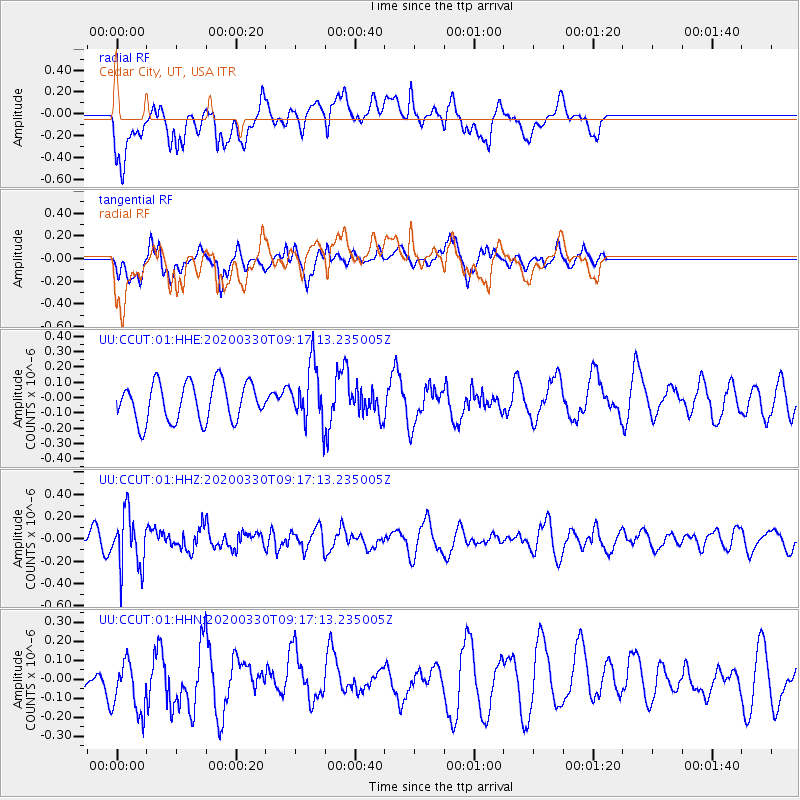
CCUT Cedar City, UT, USA - Earthquake Result Viewer
*The percent match for this event was below the threshold and hence no stack was calculated.
| Earthquake location: |
Colombia-Ecuador Border Region |
| Earthquake latitude/longitude: |
0.3/-77.7 |
| Earthquake time(UTC): |
2020/03/30 (090) 09:09:05 GMT |
| Earthquake Depth: |
128 km |
| Earthquake Magnitude: |
5.2 Mww |
| Earthquake Catalog/Contributor: |
NEIC PDE/us |
|
| Network: |
UU University of Utah Regional Network |
| Station: |
CCUT Cedar City, UT, USA |
| Lat/Lon: |
37.55 N/113.36 W |
| Elevation: |
2127 m |
|
| Distance: |
49.6 deg |
| Az: |
322.476 deg |
| Baz: |
129.973 deg |
| Ray Param: |
$rayparam |
*The percent match for this event was below the threshold and hence was not used in the summary stack. |
|
| Radial Match: |
52.797962 % |
| Radial Bump: |
400 |
| Transverse Match: |
63.64985 % |
| Transverse Bump: |
400 |
| SOD ConfigId: |
20906531 |
| Insert Time: |
2020-04-13 09:30:01.111 +0000 |
| GWidth: |
2.5 |
| Max Bumps: |
400 |
| Tol: |
0.001 |
|
Signal To Noise
| Channel | StoN | STA | LTA |
| UU:CCUT:01:HHZ:20200330T09:17:13.235005Z | 2.0172615 | 2.449205E-7 | 1.2141236E-7 |
| UU:CCUT:01:HHN:20200330T09:17:13.235005Z | 1.6475403 | 1.4791114E-7 | 8.977694E-8 |
| UU:CCUT:01:HHE:20200330T09:17:13.235005Z | 1.4796294 | 1.8566905E-7 | 1.2548348E-7 |
| Arrivals |
| Ps | |
| PpPs | |
| PsPs/PpSs | |


