You are here: Home > Network List > UU - University of Utah Regional Network Stations List
> Station FORU South Mineral Mountains, UT, USA > Earthquake Result Viewer
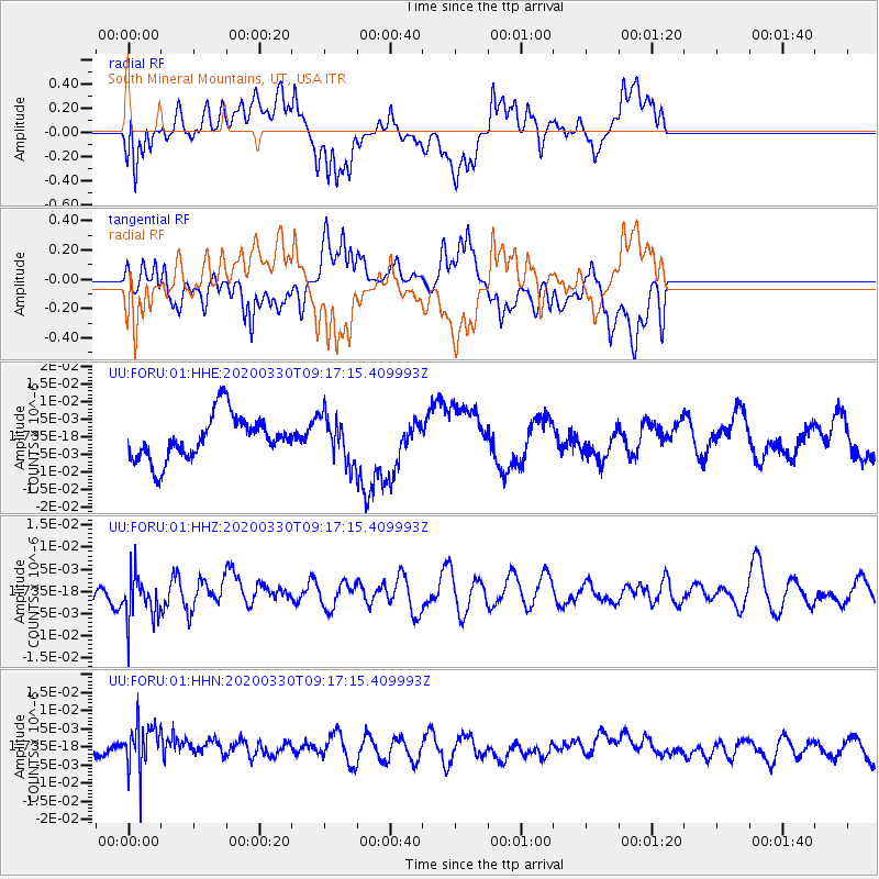
FORU South Mineral Mountains, UT, USA - Earthquake Result Viewer
*The percent match for this event was below the threshold and hence no stack was calculated.
| Earthquake location: |
Colombia-Ecuador Border Region |
| Earthquake latitude/longitude: |
0.3/-77.7 |
| Earthquake time(UTC): |
2020/03/30 (090) 09:09:05 GMT |
| Earthquake Depth: |
128 km |
| Earthquake Magnitude: |
5.2 Mww |
| Earthquake Catalog/Contributor: |
NEIC PDE/us |
|
| Network: |
UU University of Utah Regional Network |
| Station: |
FORU South Mineral Mountains, UT, USA |
| Lat/Lon: |
38.46 N/112.86 W |
| Elevation: |
1840 m |
|
| Distance: |
49.8 deg |
| Az: |
323.717 deg |
| Baz: |
131.083 deg |
| Ray Param: |
$rayparam |
*The percent match for this event was below the threshold and hence was not used in the summary stack. |
|
| Radial Match: |
64.32853 % |
| Radial Bump: |
400 |
| Transverse Match: |
56.96154 % |
| Transverse Bump: |
400 |
| SOD ConfigId: |
20906531 |
| Insert Time: |
2020-04-13 09:30:11.609 +0000 |
| GWidth: |
2.5 |
| Max Bumps: |
400 |
| Tol: |
0.001 |
|
Signal To Noise
| Channel | StoN | STA | LTA |
| UU:FORU:01:HHZ:20200330T09:17:15.409993Z | 1.4009029 | 5.271206E-9 | 3.762721E-9 |
| UU:FORU:01:HHN:20200330T09:17:15.409993Z | 2.451331 | 6.4570767E-9 | 2.6341107E-9 |
| UU:FORU:01:HHE:20200330T09:17:15.409993Z | 1.0397042 | 6.4145804E-9 | 6.169621E-9 |
| Arrivals |
| Ps | |
| PpPs | |
| PsPs/PpSs | |


