You are here: Home > Network List > G - GEOSCOPE Stations List
> Station TAOE Taiohae, Marquises islands > Earthquake Result Viewer
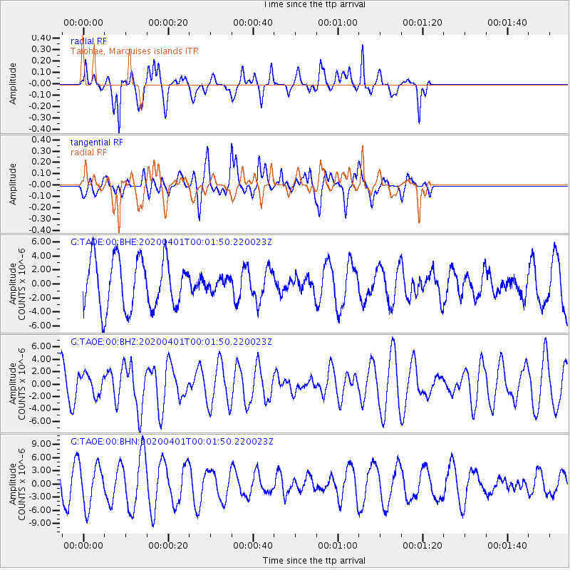
TAOE Taiohae, Marquises islands - Earthquake Result Viewer
*The percent match for this event was below the threshold and hence no stack was calculated.
| Earthquake location: |
Western Idaho |
| Earthquake latitude/longitude: |
44.5/-115.1 |
| Earthquake time(UTC): |
2020/03/31 (091) 23:52:30 GMT |
| Earthquake Depth: |
10 km |
| Earthquake Magnitude: |
6.8 Ml |
| Earthquake Catalog/Contributor: |
NEIC PDE/us |
|
| Network: |
G GEOSCOPE |
| Station: |
TAOE Taiohae, Marquises islands |
| Lat/Lon: |
8.85 S/140.15 W |
| Elevation: |
800 m |
|
| Distance: |
57.7 deg |
| Az: |
209.64 deg |
| Baz: |
20.988 deg |
| Ray Param: |
$rayparam |
*The percent match for this event was below the threshold and hence was not used in the summary stack. |
|
| Radial Match: |
74.91219 % |
| Radial Bump: |
346 |
| Transverse Match: |
64.5792 % |
| Transverse Bump: |
400 |
| SOD ConfigId: |
21144311 |
| Insert Time: |
2020-04-14 23:56:03.106 +0000 |
| GWidth: |
2.5 |
| Max Bumps: |
400 |
| Tol: |
0.001 |
|
Signal To Noise
| Channel | StoN | STA | LTA |
| G:TAOE:00:BHZ:20200401T00:01:50.220023Z | 0.6390127 | 1.6431114E-6 | 2.5713282E-6 |
| G:TAOE:00:BHN:20200401T00:01:50.220023Z | 2.4621675 | 4.670682E-6 | 1.8969798E-6 |
| G:TAOE:00:BHE:20200401T00:01:50.220023Z | 0.2389415 | 8.485097E-7 | 3.5511189E-6 |
| Arrivals |
| Ps | |
| PpPs | |
| PsPs/PpSs | |


