You are here: Home > Network List > TS - TERRAscope (Southern California Seismic Network) Stations List
> Station RPV Rancho Palos Verde California, USA > Earthquake Result Viewer
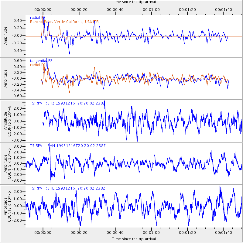
RPV Rancho Palos Verde California, USA - Earthquake Result Viewer
*The percent match for this event was below the threshold and hence no stack was calculated.
| Earthquake location: |
Near Islands, Aleutian Islands |
| Earthquake latitude/longitude: |
53.8/171.5 |
| Earthquake time(UTC): |
1993/12/16 (350) 20:11:25 GMT |
| Earthquake Depth: |
30 km |
| Earthquake Magnitude: |
5.8 MB, 5.7 MS, 6.1 UNKNOWN |
| Earthquake Catalog/Contributor: |
WHDF/NEIC |
|
| Network: |
TS TERRAscope (Southern California Seismic Network) |
| Station: |
RPV Rancho Palos Verde California, USA |
| Lat/Lon: |
33.74 N/118.40 W |
| Elevation: |
115 m |
|
| Distance: |
52.2 deg |
| Az: |
82.717 deg |
| Baz: |
315.025 deg |
| Ray Param: |
$rayparam |
*The percent match for this event was below the threshold and hence was not used in the summary stack. |
|
| Radial Match: |
58.731827 % |
| Radial Bump: |
400 |
| Transverse Match: |
49.81386 % |
| Transverse Bump: |
400 |
| SOD ConfigId: |
4480 |
| Insert Time: |
2010-02-26 14:46:03.685 +0000 |
| GWidth: |
2.5 |
| Max Bumps: |
400 |
| Tol: |
0.001 |
|
Signal To Noise
| Channel | StoN | STA | LTA |
| TS:RPV: :BHN:19931216T20:20:02.238Z | 3.255896 | 1.4464815E-6 | 4.4426523E-7 |
| TS:RPV: :BHE:19931216T20:20:02.238Z | 1.0694215 | 9.403968E-7 | 8.793509E-7 |
| TS:RPV: :BHZ:19931216T20:20:02.238Z | 1.4729874 | 1.1379294E-6 | 7.725317E-7 |
| Arrivals |
| Ps | |
| PpPs | |
| PsPs/PpSs | |


