You are here: Home > Network List > CN - Canadian National Seismograph Network Stations List
> Station INK INUVIK, NT > Earthquake Result Viewer
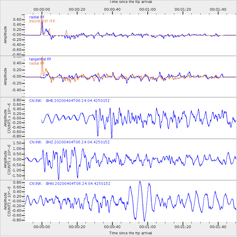
INK INUVIK, NT - Earthquake Result Viewer
*The percent match for this event was below the threshold and hence no stack was calculated.
| Earthquake location: |
Komandorskiye Ostrova Region |
| Earthquake latitude/longitude: |
54.8/166.2 |
| Earthquake time(UTC): |
2020/04/04 (095) 06:18:25 GMT |
| Earthquake Depth: |
21 km |
| Earthquake Magnitude: |
5.4 Mww |
| Earthquake Catalog/Contributor: |
NEIC PDE/us |
|
| Network: |
CN Canadian National Seismograph Network |
| Station: |
INK INUVIK, NT |
| Lat/Lon: |
68.31 N/133.53 W |
| Elevation: |
44 m |
|
| Distance: |
30.3 deg |
| Az: |
39.855 deg |
| Baz: |
274.225 deg |
| Ray Param: |
$rayparam |
*The percent match for this event was below the threshold and hence was not used in the summary stack. |
|
| Radial Match: |
72.24449 % |
| Radial Bump: |
400 |
| Transverse Match: |
72.72289 % |
| Transverse Bump: |
400 |
| SOD ConfigId: |
21144311 |
| Insert Time: |
2020-04-18 06:23:49.681 +0000 |
| GWidth: |
2.5 |
| Max Bumps: |
400 |
| Tol: |
0.001 |
|
Signal To Noise
| Channel | StoN | STA | LTA |
| CN:INK: :BHZ:20200404T06:24:04.425015Z | 5.0020194 | 5.0182064E-7 | 1.0032361E-7 |
| CN:INK: :BHN:20200404T06:24:04.425015Z | 1.0043718 | 1.4157071E-7 | 1.4095448E-7 |
| CN:INK: :BHE:20200404T06:24:04.425015Z | 2.6796901 | 3.06551E-7 | 1.1439792E-7 |
| Arrivals |
| Ps | |
| PpPs | |
| PsPs/PpSs | |


