You are here: Home > Network List > IU - Global Seismograph Network (GSN - IRIS/USGS) Stations List
> Station RSSD Black Hills, South Dakota, USA > Earthquake Result Viewer
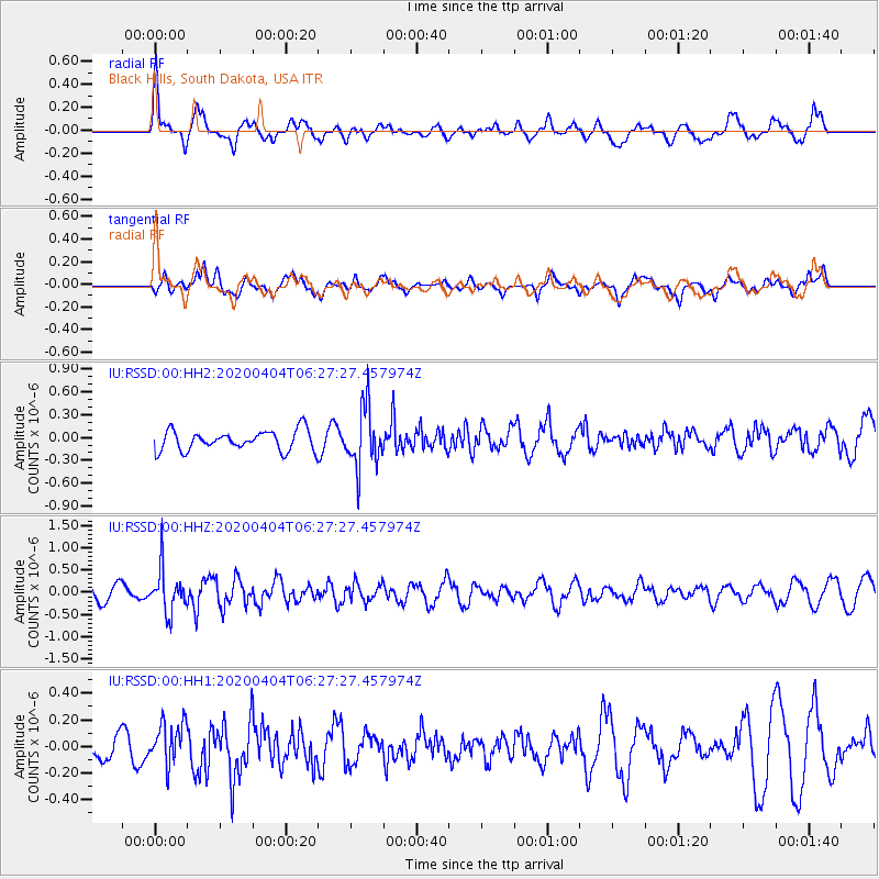
RSSD Black Hills, South Dakota, USA - Earthquake Result Viewer
*The percent match for this event was below the threshold and hence no stack was calculated.
| Earthquake location: |
Komandorskiye Ostrova Region |
| Earthquake latitude/longitude: |
54.8/166.2 |
| Earthquake time(UTC): |
2020/04/04 (095) 06:18:25 GMT |
| Earthquake Depth: |
21 km |
| Earthquake Magnitude: |
5.4 Mww |
| Earthquake Catalog/Contributor: |
NEIC PDE/us |
|
| Network: |
IU Global Seismograph Network (GSN - IRIS/USGS) |
| Station: |
RSSD Black Hills, South Dakota, USA |
| Lat/Lon: |
44.12 N/104.04 W |
| Elevation: |
2090 m |
|
| Distance: |
55.4 deg |
| Az: |
60.998 deg |
| Baz: |
315.363 deg |
| Ray Param: |
$rayparam |
*The percent match for this event was below the threshold and hence was not used in the summary stack. |
|
| Radial Match: |
58.175007 % |
| Radial Bump: |
400 |
| Transverse Match: |
48.42058 % |
| Transverse Bump: |
400 |
| SOD ConfigId: |
21144311 |
| Insert Time: |
2020-04-18 06:27:32.729 +0000 |
| GWidth: |
2.5 |
| Max Bumps: |
400 |
| Tol: |
0.001 |
|
Signal To Noise
| Channel | StoN | STA | LTA |
| IU:RSSD:00:HHZ:20200404T06:27:27.457974Z | 3.8679738 | 4.866116E-7 | 1.258053E-7 |
| IU:RSSD:00:HH1:20200404T06:27:27.457974Z | 0.96977717 | 1.669026E-7 | 1.7210408E-7 |
| IU:RSSD:00:HH2:20200404T06:27:27.457974Z | 3.0228698 | 3.9553495E-7 | 1.308475E-7 |
| Arrivals |
| Ps | |
| PpPs | |
| PsPs/PpSs | |


