You are here: Home > Network List > TS - TERRAscope (Southern California Seismic Network) Stations List
> Station RPV Rancho Palos Verde California, USA > Earthquake Result Viewer
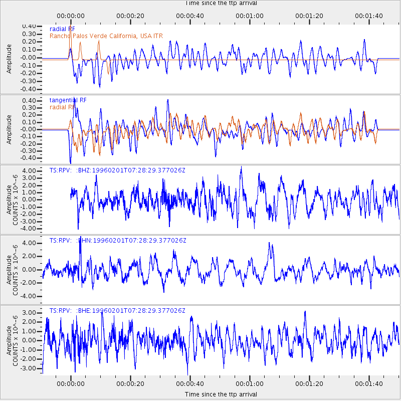
RPV Rancho Palos Verde California, USA - Earthquake Result Viewer
*The percent match for this event was below the threshold and hence no stack was calculated.
| Earthquake location: |
Kuril Islands |
| Earthquake latitude/longitude: |
44.9/146.3 |
| Earthquake time(UTC): |
1996/02/01 (032) 07:18:05 GMT |
| Earthquake Depth: |
180 km |
| Earthquake Magnitude: |
5.7 MB, 6.2 UNKNOWN, 6.2 MW |
| Earthquake Catalog/Contributor: |
WHDF/NEIC |
|
| Network: |
TS TERRAscope (Southern California Seismic Network) |
| Station: |
RPV Rancho Palos Verde California, USA |
| Lat/Lon: |
33.74 N/118.40 W |
| Elevation: |
115 m |
|
| Distance: |
70.5 deg |
| Az: |
61.667 deg |
| Baz: |
311.302 deg |
| Ray Param: |
$rayparam |
*The percent match for this event was below the threshold and hence was not used in the summary stack. |
|
| Radial Match: |
53.960484 % |
| Radial Bump: |
400 |
| Transverse Match: |
68.36838 % |
| Transverse Bump: |
400 |
| SOD ConfigId: |
4480 |
| Insert Time: |
2010-02-26 14:46:09.040 +0000 |
| GWidth: |
2.5 |
| Max Bumps: |
400 |
| Tol: |
0.001 |
|
Signal To Noise
| Channel | StoN | STA | LTA |
| TS:RPV: :BHN:19960201T07:28:29.377026Z | 2.1218452 | 1.4428321E-6 | 6.799893E-7 |
| TS:RPV: :BHE:19960201T07:28:29.377026Z | 0.9117023 | 1.2033196E-6 | 1.3198603E-6 |
| TS:RPV: :BHZ:19960201T07:28:29.377026Z | 1.182405 | 1.337282E-6 | 1.1309847E-6 |
| Arrivals |
| Ps | |
| PpPs | |
| PsPs/PpSs | |


