You are here: Home > Network List > US - United States National Seismic Network Stations List
> Station HAWA Hanford, Washington, USA > Earthquake Result Viewer
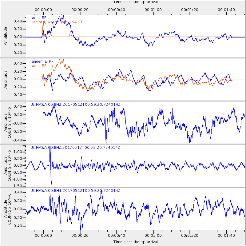
HAWA Hanford, Washington, USA - Earthquake Result Viewer
*The percent match for this event was below the threshold and hence no stack was calculated.
| Earthquake location: |
Kermadec Islands Region |
| Earthquake latitude/longitude: |
-27.5/-176.9 |
| Earthquake time(UTC): |
2017/05/12 (132) 00:46:52 GMT |
| Earthquake Depth: |
10 km |
| Earthquake Magnitude: |
5.8 mb |
| Earthquake Catalog/Contributor: |
NEIC PDE/us |
|
| Network: |
US United States National Seismic Network |
| Station: |
HAWA Hanford, Washington, USA |
| Lat/Lon: |
46.39 N/119.53 W |
| Elevation: |
364 m |
|
| Distance: |
90.0 deg |
| Az: |
35.638 deg |
| Baz: |
228.41 deg |
| Ray Param: |
$rayparam |
*The percent match for this event was below the threshold and hence was not used in the summary stack. |
|
| Radial Match: |
42.48463 % |
| Radial Bump: |
400 |
| Transverse Match: |
52.521297 % |
| Transverse Bump: |
400 |
| SOD ConfigId: |
2028011 |
| Insert Time: |
2017-05-26 01:00:13.967 +0000 |
| GWidth: |
2.5 |
| Max Bumps: |
400 |
| Tol: |
0.001 |
|
Signal To Noise
| Channel | StoN | STA | LTA |
| US:HAWA:00:BHZ:20170512T00:59:20.724014Z | 4.8000855 | 5.52387E-7 | 1.15078585E-7 |
| US:HAWA:00:BH1:20170512T00:59:20.724014Z | 0.9008536 | 1.1104943E-7 | 1.2327135E-7 |
| US:HAWA:00:BH2:20170512T00:59:20.724014Z | 0.9261995 | 1.5604735E-7 | 1.6848135E-7 |
| Arrivals |
| Ps | |
| PpPs | |
| PsPs/PpSs | |


