You are here: Home > Network List > US - United States National Seismic Network Stations List
> Station MNTX Cornudas Mountains, Texas, USA > Earthquake Result Viewer
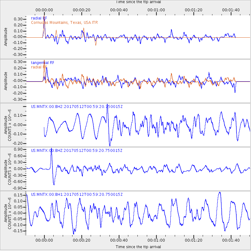
MNTX Cornudas Mountains, Texas, USA - Earthquake Result Viewer
*The percent match for this event was below the threshold and hence no stack was calculated.
| Earthquake location: |
Kermadec Islands Region |
| Earthquake latitude/longitude: |
-27.5/-176.9 |
| Earthquake time(UTC): |
2017/05/12 (132) 00:46:52 GMT |
| Earthquake Depth: |
10 km |
| Earthquake Magnitude: |
5.8 mb |
| Earthquake Catalog/Contributor: |
NEIC PDE/us |
|
| Network: |
US United States National Seismic Network |
| Station: |
MNTX Cornudas Mountains, Texas, USA |
| Lat/Lon: |
31.70 N/105.38 W |
| Elevation: |
404 m |
|
| Distance: |
90.0 deg |
| Az: |
53.927 deg |
| Baz: |
237.401 deg |
| Ray Param: |
$rayparam |
*The percent match for this event was below the threshold and hence was not used in the summary stack. |
|
| Radial Match: |
60.675877 % |
| Radial Bump: |
387 |
| Transverse Match: |
68.567444 % |
| Transverse Bump: |
379 |
| SOD ConfigId: |
2028011 |
| Insert Time: |
2017-05-26 01:00:36.672 +0000 |
| GWidth: |
2.5 |
| Max Bumps: |
400 |
| Tol: |
0.001 |
|
Signal To Noise
| Channel | StoN | STA | LTA |
| US:MNTX:00:BHZ:20170512T00:59:20.750015Z | 3.9363198 | 3.1003694E-7 | 7.876315E-8 |
| US:MNTX:00:BH1:20170512T00:59:20.750015Z | 0.5069107 | 4.703863E-8 | 9.279471E-8 |
| US:MNTX:00:BH2:20170512T00:59:20.750015Z | 1.3371142 | 9.466113E-8 | 7.0795096E-8 |
| Arrivals |
| Ps | |
| PpPs | |
| PsPs/PpSs | |


