You are here: Home > Network List > AV - Alaska Volcano Observatory Stations List
> Station AMKA Regional Station, Amchitka Island, Alaska > Earthquake Result Viewer
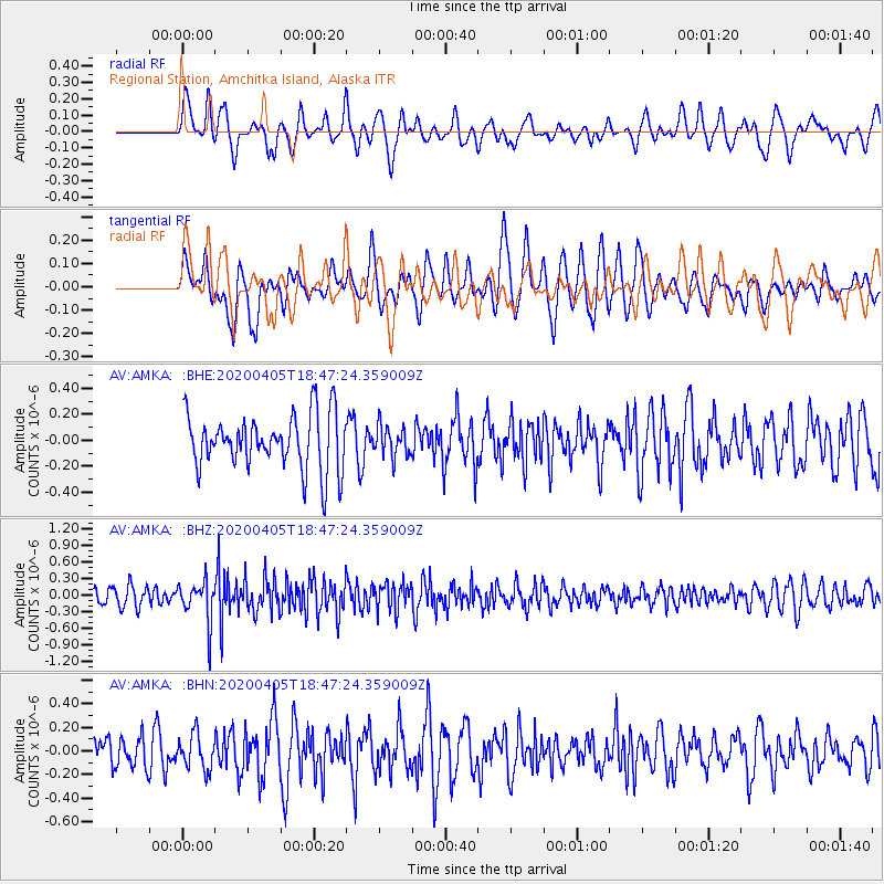
AMKA Regional Station, Amchitka Island, Alaska - Earthquake Result Viewer
*The percent match for this event was below the threshold and hence no stack was calculated.
| Earthquake location: |
Northern Molucca Sea |
| Earthquake latitude/longitude: |
1.4/126.4 |
| Earthquake time(UTC): |
2020/04/05 (096) 18:37:10 GMT |
| Earthquake Depth: |
54 km |
| Earthquake Magnitude: |
5.9 Mww |
| Earthquake Catalog/Contributor: |
NEIC PDE/us |
|
| Network: |
AV Alaska Volcano Observatory |
| Station: |
AMKA Regional Station, Amchitka Island, Alaska |
| Lat/Lon: |
51.38 N/179.30 E |
| Elevation: |
116 m |
|
| Distance: |
66.6 deg |
| Az: |
32.983 deg |
| Baz: |
240.269 deg |
| Ray Param: |
$rayparam |
*The percent match for this event was below the threshold and hence was not used in the summary stack. |
|
| Radial Match: |
56.22536 % |
| Radial Bump: |
400 |
| Transverse Match: |
55.781628 % |
| Transverse Bump: |
400 |
| SOD ConfigId: |
21144311 |
| Insert Time: |
2020-04-19 18:40:06.013 +0000 |
| GWidth: |
2.5 |
| Max Bumps: |
400 |
| Tol: |
0.001 |
|
Signal To Noise
| Channel | StoN | STA | LTA |
| AV:AMKA: :BHZ:20200405T18:47:24.359009Z | 2.3780591 | 3.6677025E-7 | 1.5423092E-7 |
| AV:AMKA: :BHN:20200405T18:47:24.359009Z | 0.9363942 | 1.4901457E-7 | 1.5913658E-7 |
| AV:AMKA: :BHE:20200405T18:47:24.359009Z | 0.55876964 | 1.18210274E-7 | 2.1155458E-7 |
| Arrivals |
| Ps | |
| PpPs | |
| PsPs/PpSs | |


