You are here: Home > Network List > TX - Texas Seismological Network Stations List
> Station WTFS Witchita Falls > Earthquake Result Viewer
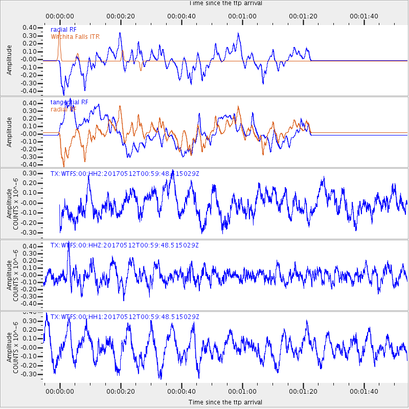
WTFS Witchita Falls - Earthquake Result Viewer
*The percent match for this event was below the threshold and hence no stack was calculated.
| Earthquake location: |
Kermadec Islands Region |
| Earthquake latitude/longitude: |
-27.5/-176.9 |
| Earthquake time(UTC): |
2017/05/12 (132) 00:46:52 GMT |
| Earthquake Depth: |
10 km |
| Earthquake Magnitude: |
5.8 mb |
| Earthquake Catalog/Contributor: |
NEIC PDE/us |
|
| Network: |
TX Texas Seismological Network |
| Station: |
WTFS Witchita Falls |
| Lat/Lon: |
33.77 N/98.46 W |
| Elevation: |
277 m |
|
| Distance: |
96.0 deg |
| Az: |
55.141 deg |
| Baz: |
241.063 deg |
| Ray Param: |
$rayparam |
*The percent match for this event was below the threshold and hence was not used in the summary stack. |
|
| Radial Match: |
52.33554 % |
| Radial Bump: |
400 |
| Transverse Match: |
50.395226 % |
| Transverse Bump: |
400 |
| SOD ConfigId: |
2028011 |
| Insert Time: |
2017-05-26 01:03:13.030 +0000 |
| GWidth: |
2.5 |
| Max Bumps: |
400 |
| Tol: |
0.001 |
|
Signal To Noise
| Channel | StoN | STA | LTA |
| TX:WTFS:00:HHZ:20170512T00:59:48.515029Z | 1.5749446 | 1.5146053E-7 | 9.61688E-8 |
| TX:WTFS:00:HH1:20170512T00:59:48.515029Z | 1.7550052 | 1.6220777E-7 | 9.24258E-8 |
| TX:WTFS:00:HH2:20170512T00:59:48.515029Z | 1.301628 | 1.3592356E-7 | 1.044258E-7 |
| Arrivals |
| Ps | |
| PpPs | |
| PsPs/PpSs | |


