You are here: Home > Network List > AV - Alaska Volcano Observatory Stations List
> Station PLBL Mt. Peulik Volcano, Alaska > Earthquake Result Viewer
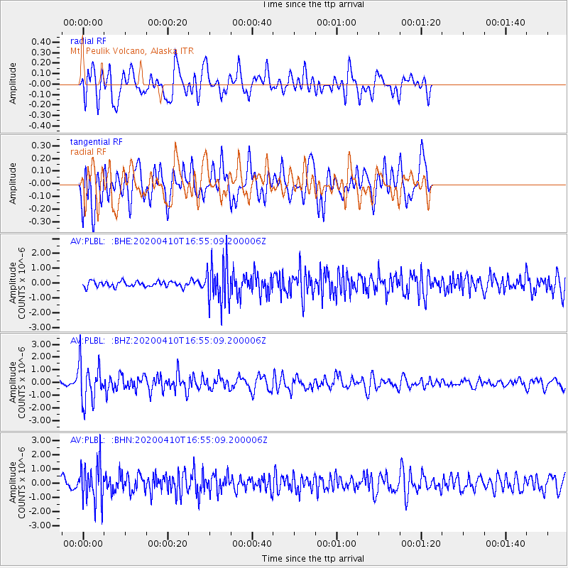
PLBL Mt. Peulik Volcano, Alaska - Earthquake Result Viewer
*The percent match for this event was below the threshold and hence no stack was calculated.
| Earthquake location: |
Philippine Islands Region |
| Earthquake latitude/longitude: |
20.4/122.1 |
| Earthquake time(UTC): |
2020/04/10 (101) 16:44:55 GMT |
| Earthquake Depth: |
149 km |
| Earthquake Magnitude: |
5.9 mww |
| Earthquake Catalog/Contributor: |
NEIC PDE/us |
|
| Network: |
AV Alaska Volcano Observatory |
| Station: |
PLBL Mt. Peulik Volcano, Alaska |
| Lat/Lon: |
57.70 N/156.82 W |
| Elevation: |
461 m |
|
| Distance: |
68.2 deg |
| Az: |
34.831 deg |
| Baz: |
273.91 deg |
| Ray Param: |
$rayparam |
*The percent match for this event was below the threshold and hence was not used in the summary stack. |
|
| Radial Match: |
72.28574 % |
| Radial Bump: |
400 |
| Transverse Match: |
71.46645 % |
| Transverse Bump: |
400 |
| SOD ConfigId: |
21166931 |
| Insert Time: |
2020-04-24 16:50:21.748 +0000 |
| GWidth: |
2.5 |
| Max Bumps: |
400 |
| Tol: |
0.001 |
|
Signal To Noise
| Channel | StoN | STA | LTA |
| AV:PLBL: :BHZ:20200410T16:55:09.200006Z | 10.886451 | 1.5957229E-6 | 1.465788E-7 |
| AV:PLBL: :BHN:20200410T16:55:09.200006Z | 3.7726278 | 1.3484031E-6 | 3.5741746E-7 |
| AV:PLBL: :BHE:20200410T16:55:09.200006Z | 7.3825517 | 1.3939429E-6 | 1.8881586E-7 |
| Arrivals |
| Ps | |
| PpPs | |
| PsPs/PpSs | |


