You are here: Home > Network List > CN - Canadian National Seismograph Network Stations List
> Station INK INUVIK, NT > Earthquake Result Viewer
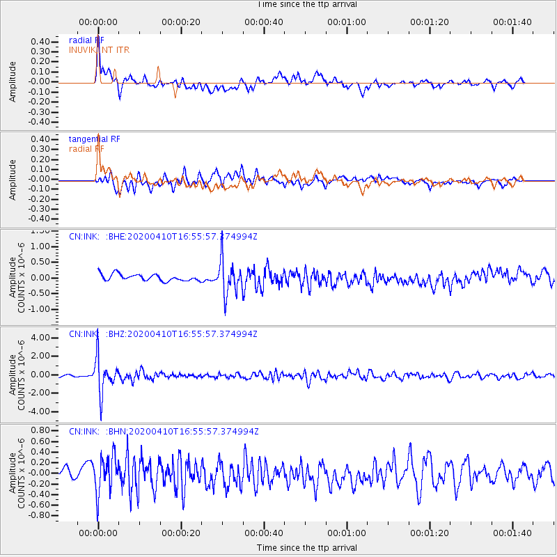
INK INUVIK, NT - Earthquake Result Viewer
*The percent match for this event was below the threshold and hence no stack was calculated.
| Earthquake location: |
Philippine Islands Region |
| Earthquake latitude/longitude: |
20.4/122.1 |
| Earthquake time(UTC): |
2020/04/10 (101) 16:44:55 GMT |
| Earthquake Depth: |
149 km |
| Earthquake Magnitude: |
5.9 mww |
| Earthquake Catalog/Contributor: |
NEIC PDE/us |
|
| Network: |
CN Canadian National Seismograph Network |
| Station: |
INK INUVIK, NT |
| Lat/Lon: |
68.31 N/133.53 W |
| Elevation: |
44 m |
|
| Distance: |
76.4 deg |
| Az: |
21.754 deg |
| Baz: |
290.784 deg |
| Ray Param: |
$rayparam |
*The percent match for this event was below the threshold and hence was not used in the summary stack. |
|
| Radial Match: |
75.3337 % |
| Radial Bump: |
400 |
| Transverse Match: |
67.54516 % |
| Transverse Bump: |
400 |
| SOD ConfigId: |
21166931 |
| Insert Time: |
2020-04-24 16:53:04.921 +0000 |
| GWidth: |
2.5 |
| Max Bumps: |
400 |
| Tol: |
0.001 |
|
Signal To Noise
| Channel | StoN | STA | LTA |
| CN:INK: :BHZ:20200410T16:55:57.374994Z | 15.031545 | 1.9115696E-6 | 1.2717052E-7 |
| CN:INK: :BHN:20200410T16:55:57.374994Z | 2.4751456 | 3.6251174E-7 | 1.4646078E-7 |
| CN:INK: :BHE:20200410T16:55:57.374994Z | 5.239814 | 5.518263E-7 | 1.053141E-7 |
| Arrivals |
| Ps | |
| PpPs | |
| PsPs/PpSs | |


