You are here: Home > Network List > G - GEOSCOPE Stations List
> Station KIP Kipapa, Hawai, U.S.A. (Pacific Ocean) > Earthquake Result Viewer
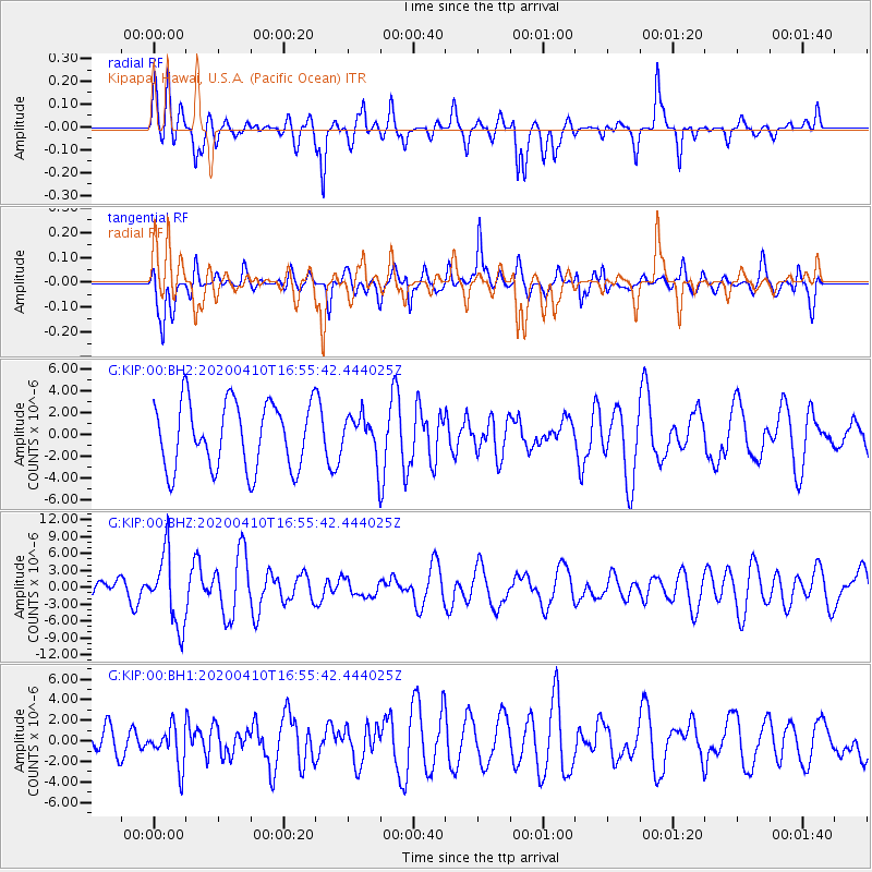
KIP Kipapa, Hawai, U.S.A. (Pacific Ocean) - Earthquake Result Viewer
*The percent match for this event was below the threshold and hence no stack was calculated.
| Earthquake location: |
Philippine Islands Region |
| Earthquake latitude/longitude: |
20.4/122.1 |
| Earthquake time(UTC): |
2020/04/10 (101) 16:44:55 GMT |
| Earthquake Depth: |
149 km |
| Earthquake Magnitude: |
5.9 mww |
| Earthquake Catalog/Contributor: |
NEIC PDE/us |
|
| Network: |
G GEOSCOPE |
| Station: |
KIP Kipapa, Hawai, U.S.A. (Pacific Ocean) |
| Lat/Lon: |
21.42 N/158.01 W |
| Elevation: |
70 m |
|
| Distance: |
73.8 deg |
| Az: |
72.813 deg |
| Baz: |
285.92 deg |
| Ray Param: |
$rayparam |
*The percent match for this event was below the threshold and hence was not used in the summary stack. |
|
| Radial Match: |
57.406227 % |
| Radial Bump: |
400 |
| Transverse Match: |
55.57634 % |
| Transverse Bump: |
400 |
| SOD ConfigId: |
21166931 |
| Insert Time: |
2020-04-24 16:54:35.718 +0000 |
| GWidth: |
2.5 |
| Max Bumps: |
400 |
| Tol: |
0.001 |
|
Signal To Noise
| Channel | StoN | STA | LTA |
| G:KIP:00:BHZ:20200410T16:55:42.444025Z | 3.8031232 | 6.3482507E-6 | 1.6692203E-6 |
| G:KIP:00:BH1:20200410T16:55:42.444025Z | 0.8857914 | 1.9029866E-6 | 2.148346E-6 |
| G:KIP:00:BH2:20200410T16:55:42.444025Z | 0.622802 | 1.8838201E-6 | 3.0247495E-6 |
| Arrivals |
| Ps | |
| PpPs | |
| PsPs/PpSs | |


