You are here: Home > Network List > IW - Intermountain West Stations List
> Station DLMT Dillon, Montana, USA > Earthquake Result Viewer
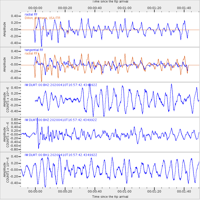
DLMT Dillon, Montana, USA - Earthquake Result Viewer
*The percent match for this event was below the threshold and hence no stack was calculated.
| Earthquake location: |
Philippine Islands Region |
| Earthquake latitude/longitude: |
20.4/122.1 |
| Earthquake time(UTC): |
2020/04/10 (101) 16:44:55 GMT |
| Earthquake Depth: |
149 km |
| Earthquake Magnitude: |
5.9 mww |
| Earthquake Catalog/Contributor: |
NEIC PDE/us |
|
| Network: |
IW Intermountain West |
| Station: |
DLMT Dillon, Montana, USA |
| Lat/Lon: |
45.36 N/112.60 W |
| Elevation: |
1569 m |
|
| Distance: |
97.8 deg |
| Az: |
35.513 deg |
| Baz: |
309.398 deg |
| Ray Param: |
$rayparam |
*The percent match for this event was below the threshold and hence was not used in the summary stack. |
|
| Radial Match: |
65.08833 % |
| Radial Bump: |
400 |
| Transverse Match: |
54.136826 % |
| Transverse Bump: |
397 |
| SOD ConfigId: |
21166931 |
| Insert Time: |
2020-04-24 16:56:43.461 +0000 |
| GWidth: |
2.5 |
| Max Bumps: |
400 |
| Tol: |
0.001 |
|
Signal To Noise
| Channel | StoN | STA | LTA |
| IW:DLMT:00:BHZ:20200410T16:57:42.434992Z | 3.1971567 | 3.831317E-7 | 1.1983514E-7 |
| IW:DLMT:00:BH1:20200410T16:57:42.434992Z | 1.6898416 | 2.4833733E-7 | 1.4695894E-7 |
| IW:DLMT:00:BH2:20200410T16:57:42.434992Z | 1.9627589 | 2.6379152E-7 | 1.3439832E-7 |
| Arrivals |
| Ps | |
| PpPs | |
| PsPs/PpSs | |


