You are here: Home > Network List > TA - USArray Transportable Network (new EarthScope stations) Stations List
> Station L15K Ungalak Mountain, AK, USA > Earthquake Result Viewer
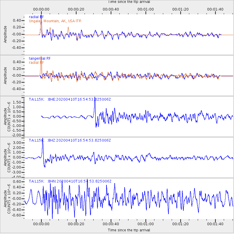
L15K Ungalak Mountain, AK, USA - Earthquake Result Viewer
*The percent match for this event was below the threshold and hence no stack was calculated.
| Earthquake location: |
Philippine Islands Region |
| Earthquake latitude/longitude: |
20.4/122.1 |
| Earthquake time(UTC): |
2020/04/10 (101) 16:44:55 GMT |
| Earthquake Depth: |
149 km |
| Earthquake Magnitude: |
5.9 mww |
| Earthquake Catalog/Contributor: |
NEIC PDE/us |
|
| Network: |
TA USArray Transportable Network (new EarthScope stations) |
| Station: |
L15K Ungalak Mountain, AK, USA |
| Lat/Lon: |
61.68 N/161.49 W |
| Elevation: |
219 m |
|
| Distance: |
65.8 deg |
| Az: |
30.546 deg |
| Baz: |
268.211 deg |
| Ray Param: |
$rayparam |
*The percent match for this event was below the threshold and hence was not used in the summary stack. |
|
| Radial Match: |
76.88272 % |
| Radial Bump: |
400 |
| Transverse Match: |
59.568623 % |
| Transverse Bump: |
400 |
| SOD ConfigId: |
21166931 |
| Insert Time: |
2020-04-24 17:01:42.220 +0000 |
| GWidth: |
2.5 |
| Max Bumps: |
400 |
| Tol: |
0.001 |
|
Signal To Noise
| Channel | StoN | STA | LTA |
| TA:L15K: :BHZ:20200410T16:54:53.825006Z | 9.608798 | 1.3038384E-6 | 1.3569215E-7 |
| TA:L15K: :BHN:20200410T16:54:53.825006Z | 1.8616427 | 2.4507017E-7 | 1.316419E-7 |
| TA:L15K: :BHE:20200410T16:54:53.825006Z | 10.295364 | 7.300742E-7 | 7.0912904E-8 |
| Arrivals |
| Ps | |
| PpPs | |
| PsPs/PpSs | |


