You are here: Home > Network List > TA - USArray Transportable Network (new EarthScope stations) Stations List
> Station M31M Drury Creek, Yukon, CA > Earthquake Result Viewer
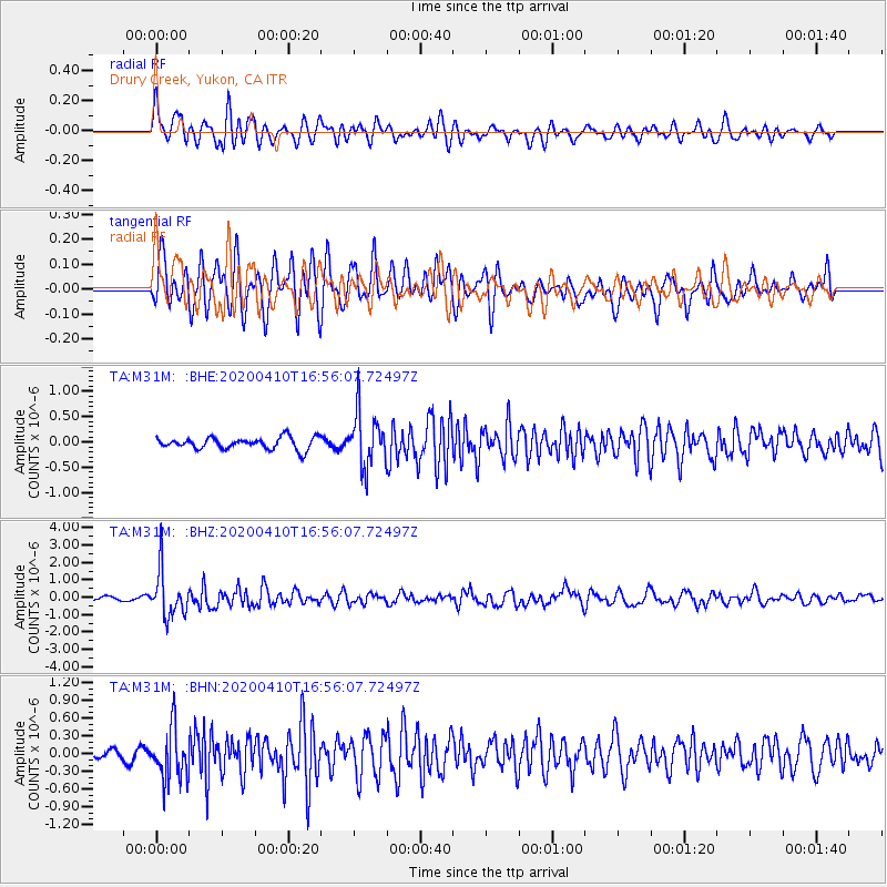
M31M Drury Creek, Yukon, CA - Earthquake Result Viewer
*The percent match for this event was below the threshold and hence no stack was calculated.
| Earthquake location: |
Philippine Islands Region |
| Earthquake latitude/longitude: |
20.4/122.1 |
| Earthquake time(UTC): |
2020/04/10 (101) 16:44:55 GMT |
| Earthquake Depth: |
149 km |
| Earthquake Magnitude: |
5.9 mww |
| Earthquake Catalog/Contributor: |
NEIC PDE/us |
|
| Network: |
TA USArray Transportable Network (new EarthScope stations) |
| Station: |
M31M Drury Creek, Yukon, CA |
| Lat/Lon: |
62.20 N/134.39 W |
| Elevation: |
639 m |
|
| Distance: |
78.2 deg |
| Az: |
27.752 deg |
| Baz: |
291.318 deg |
| Ray Param: |
$rayparam |
*The percent match for this event was below the threshold and hence was not used in the summary stack. |
|
| Radial Match: |
61.24101 % |
| Radial Bump: |
400 |
| Transverse Match: |
67.64827 % |
| Transverse Bump: |
400 |
| SOD ConfigId: |
21166931 |
| Insert Time: |
2020-04-24 17:02:04.765 +0000 |
| GWidth: |
2.5 |
| Max Bumps: |
400 |
| Tol: |
0.001 |
|
Signal To Noise
| Channel | StoN | STA | LTA |
| TA:M31M: :BHZ:20200410T16:56:07.72497Z | 9.106803 | 1.3029586E-6 | 1.4307531E-7 |
| TA:M31M: :BHN:20200410T16:56:07.72497Z | 3.115723 | 4.3470118E-7 | 1.3951856E-7 |
| TA:M31M: :BHE:20200410T16:56:07.72497Z | 4.6462617 | 5.362254E-7 | 1.15410074E-7 |
| Arrivals |
| Ps | |
| PpPs | |
| PsPs/PpSs | |


