You are here: Home > Network List > TA - USArray Transportable Network (new EarthScope stations) Stations List
> Station O28M Mount Upton, YT, CAN > Earthquake Result Viewer
O28M Mount Upton, YT, CAN - Earthquake Result Viewer

| Earthquake location: |
Philippine Islands Region |
| Earthquake latitude/longitude: |
20.4/122.1 |
| Earthquake time(UTC): |
2020/04/10 (101) 16:44:55 GMT |
| Earthquake Depth: |
149 km |
| Earthquake Magnitude: |
5.9 mww |
| Earthquake Catalog/Contributor: |
NEIC PDE/us |
|
| Network: |
TA USArray Transportable Network (new EarthScope stations) |
| Station: |
O28M Mount Upton, YT, CAN |
| Lat/Lon: |
60.77 N/140.19 W |
| Elevation: |
2622 m |
|
| Distance: |
76.1 deg |
| Az: |
30.073 deg |
| Baz: |
286.744 deg |
| Ray Param: |
0.05087764 |
| Estimated Moho Depth: |
59.25 km |
| Estimated Crust Vp/Vs: |
1.68 |
| Assumed Crust Vp: |
6.566 km/s |
| Estimated Crust Vs: |
3.908 km/s |
| Estimated Crust Poisson's Ratio: |
0.23 |
|
| Radial Match: |
83.79111 % |
| Radial Bump: |
400 |
| Transverse Match: |
77.47786 % |
| Transverse Bump: |
400 |
| SOD ConfigId: |
21166931 |
| Insert Time: |
2020-04-24 17:02:24.236 +0000 |
| GWidth: |
2.5 |
| Max Bumps: |
400 |
| Tol: |
0.001 |
|
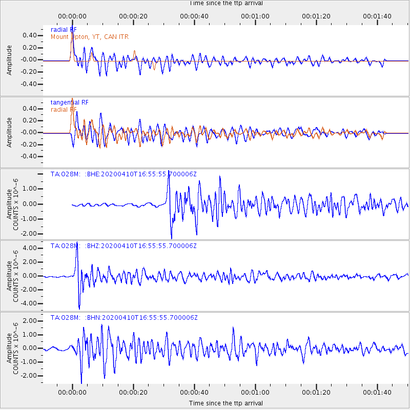
Signal To Noise
| Channel | StoN | STA | LTA |
| TA:O28M: :BHZ:20200410T16:55:55.700006Z | 13.934845 | 2.096888E-6 | 1.5047803E-7 |
| TA:O28M: :BHN:20200410T16:55:55.700006Z | 9.453653 | 8.158609E-7 | 8.630112E-8 |
| TA:O28M: :BHE:20200410T16:55:55.700006Z | 15.877515 | 1.0301911E-6 | 6.488365E-8 |
| Arrivals |
| Ps | 6.4 SECOND |
| PpPs | 23 SECOND |
| PsPs/PpSs | 30 SECOND |


