You are here: Home > Network List > TA - USArray Transportable Network (new EarthScope stations) Stations List
> Station R33M Jennings River, BC, CAN > Earthquake Result Viewer
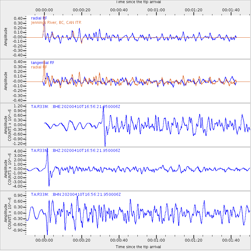
R33M Jennings River, BC, CAN - Earthquake Result Viewer
*The percent match for this event was below the threshold and hence no stack was calculated.
| Earthquake location: |
Philippine Islands Region |
| Earthquake latitude/longitude: |
20.4/122.1 |
| Earthquake time(UTC): |
2020/04/10 (101) 16:44:55 GMT |
| Earthquake Depth: |
149 km |
| Earthquake Magnitude: |
5.9 mww |
| Earthquake Catalog/Contributor: |
NEIC PDE/us |
|
| Network: |
TA USArray Transportable Network (new EarthScope stations) |
| Station: |
R33M Jennings River, BC, CAN |
| Lat/Lon: |
59.39 N/130.97 W |
| Elevation: |
1437 m |
|
| Distance: |
80.9 deg |
| Az: |
29.722 deg |
| Baz: |
294.659 deg |
| Ray Param: |
$rayparam |
*The percent match for this event was below the threshold and hence was not used in the summary stack. |
|
| Radial Match: |
73.15335 % |
| Radial Bump: |
400 |
| Transverse Match: |
63.178787 % |
| Transverse Bump: |
400 |
| SOD ConfigId: |
21166931 |
| Insert Time: |
2020-04-24 17:02:43.312 +0000 |
| GWidth: |
2.5 |
| Max Bumps: |
400 |
| Tol: |
0.001 |
|
Signal To Noise
| Channel | StoN | STA | LTA |
| TA:R33M: :BHZ:20200410T16:56:21.950006Z | 12.226359 | 1.8780329E-6 | 1.5360524E-7 |
| TA:R33M: :BHN:20200410T16:56:21.950006Z | 2.448573 | 4.47511E-7 | 1.82764E-7 |
| TA:R33M: :BHE:20200410T16:56:21.950006Z | 3.7721863 | 5.6634525E-7 | 1.5013713E-7 |
| Arrivals |
| Ps | |
| PpPs | |
| PsPs/PpSs | |


