SBC Santa Barbara, California, USA - Earthquake Result Viewer
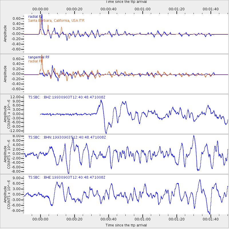
Earthquake location: Near Coast Of Chiapas, Mexico
Earthquake latitude/longitude: 14.6/-92.8
Earthquake time(UTC): 1993/09/03 (246) 12:35:01 GMT
Earthquake Depth: 33 km
Earthquake Magnitude: 5.8 MB, 6.8 MS, 6.8 UNKNOWN, 6.8 MW
Earthquake Catalog/Contributor: WHDF/NEIC
Network: TS TERRAscope (Southern California Seismic Network)
Station: SBC Santa Barbara, California, USA
Lat/Lon: 34.44 N/119.71 W
Elevation: 90 m
Distance: 31.3 deg
Az: 314.004 deg
Baz: 122.568 deg
Ray Param: 0.079069465
Estimated Moho Depth: 12.75 km
Estimated Crust Vp/Vs: 1.60
Assumed Crust Vp: 6.1 km/s
Estimated Crust Vs: 3.812 km/s
Estimated Crust Poisson's Ratio: 0.18
Radial Match: 87.88261 %
Radial Bump: 400
Transverse Match: 84.97028 %
Transverse Bump: 400
SOD ConfigId: 16938
Insert Time: 2010-02-26 14:46:36.684 +0000
GWidth: 2.5
Max Bumps: 400
Tol: 0.001

Signal To Noise

ChannelStoNSTALTA
TS:SBC: :BHN:19930903T12:40:48.471008Z1.621836.2229986E-73.8370226E-7
TS:SBC: :BHE:19930903T12:40:48.471008Z1.74549238.6568855E-74.959566E-7
TS:SBC: :BHZ:19930903T12:40:48.471008Z9.0367632.4580872E-62.7200971E-7
Arrivals
Ps1.4 SECOND
PpPs5.0 SECOND
PsPs/PpSs6.4 SECOND