You are here: Home > Network List > US - United States National Seismic Network Stations List
> Station MSO Missoula, Montana, USA > Earthquake Result Viewer
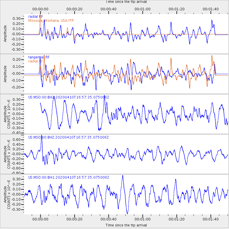
MSO Missoula, Montana, USA - Earthquake Result Viewer
*The percent match for this event was below the threshold and hence no stack was calculated.
| Earthquake location: |
Philippine Islands Region |
| Earthquake latitude/longitude: |
20.4/122.1 |
| Earthquake time(UTC): |
2020/04/10 (101) 16:44:55 GMT |
| Earthquake Depth: |
149 km |
| Earthquake Magnitude: |
5.9 mww |
| Earthquake Catalog/Contributor: |
NEIC PDE/us |
|
| Network: |
US United States National Seismic Network |
| Station: |
MSO Missoula, Montana, USA |
| Lat/Lon: |
46.83 N/113.94 W |
| Elevation: |
1264 m |
|
| Distance: |
96.2 deg |
| Az: |
34.956 deg |
| Baz: |
308.5 deg |
| Ray Param: |
$rayparam |
*The percent match for this event was below the threshold and hence was not used in the summary stack. |
|
| Radial Match: |
50.161198 % |
| Radial Bump: |
400 |
| Transverse Match: |
42.08303 % |
| Transverse Bump: |
400 |
| SOD ConfigId: |
21166931 |
| Insert Time: |
2020-04-24 17:03:42.592 +0000 |
| GWidth: |
2.5 |
| Max Bumps: |
400 |
| Tol: |
0.001 |
|
Signal To Noise
| Channel | StoN | STA | LTA |
| US:MSO:00:BHZ:20200410T16:57:35.075006Z | 3.1163487 | 3.2595477E-7 | 1.0459509E-7 |
| US:MSO:00:BH1:20200410T16:57:35.075006Z | 1.2622635 | 1.1581568E-7 | 9.1752376E-8 |
| US:MSO:00:BH2:20200410T16:57:35.075006Z | 1.0521849 | 1.9125629E-7 | 1.8177062E-7 |
| Arrivals |
| Ps | |
| PpPs | |
| PsPs/PpSs | |


