You are here: Home > Network List > UW - Pacific Northwest Regional Seismic Network Stations List
> Station UMAT Pilot Rock, OR, USA > Earthquake Result Viewer
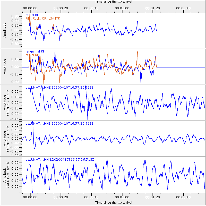
UMAT Pilot Rock, OR, USA - Earthquake Result Viewer
*The percent match for this event was below the threshold and hence no stack was calculated.
| Earthquake location: |
Philippine Islands Region |
| Earthquake latitude/longitude: |
20.4/122.1 |
| Earthquake time(UTC): |
2020/04/10 (101) 16:44:55 GMT |
| Earthquake Depth: |
149 km |
| Earthquake Magnitude: |
5.9 mww |
| Earthquake Catalog/Contributor: |
NEIC PDE/us |
|
| Network: |
UW Pacific Northwest Regional Seismic Network |
| Station: |
UMAT Pilot Rock, OR, USA |
| Lat/Lon: |
45.29 N/118.96 W |
| Elevation: |
1318 m |
|
| Distance: |
94.3 deg |
| Az: |
38.286 deg |
| Baz: |
304.593 deg |
| Ray Param: |
$rayparam |
*The percent match for this event was below the threshold and hence was not used in the summary stack. |
|
| Radial Match: |
53.59062 % |
| Radial Bump: |
400 |
| Transverse Match: |
50.36021 % |
| Transverse Bump: |
382 |
| SOD ConfigId: |
21166931 |
| Insert Time: |
2020-04-24 17:04:30.587 +0000 |
| GWidth: |
2.5 |
| Max Bumps: |
400 |
| Tol: |
0.001 |
|
Signal To Noise
| Channel | StoN | STA | LTA |
| UW:UMAT: :HHZ:20200410T16:57:26.518Z | 4.0946965 | 5.003548E-7 | 1.2219583E-7 |
| UW:UMAT: :HHN:20200410T16:57:26.518Z | 1.1817 | 1.3334652E-7 | 1.12842955E-7 |
| UW:UMAT: :HHE:20200410T16:57:26.518Z | 0.9624658 | 1.1286079E-7 | 1.17262125E-7 |
| Arrivals |
| Ps | |
| PpPs | |
| PsPs/PpSs | |


