You are here: Home > Network List > TS - TERRAscope (Southern California Seismic Network) Stations List
> Station SBC Santa Barbara, California, USA > Earthquake Result Viewer
SBC Santa Barbara, California, USA - Earthquake Result Viewer

| Earthquake location: |
Southeast Of Honshu, Japan |
| Earthquake latitude/longitude: |
32.0/137.9 |
| Earthquake time(UTC): |
1993/10/11 (284) 15:54:22 GMT |
| Earthquake Depth: |
365 km |
| Earthquake Magnitude: |
6.5 MB, 6.8 UNKNOWN, 6.9 MW |
| Earthquake Catalog/Contributor: |
WHDF/NEIC |
|
| Network: |
TS TERRAscope (Southern California Seismic Network) |
| Station: |
SBC Santa Barbara, California, USA |
| Lat/Lon: |
34.44 N/119.71 W |
| Elevation: |
90 m |
|
| Distance: |
81.6 deg |
| Az: |
54.665 deg |
| Baz: |
303.004 deg |
| Ray Param: |
0.046476226 |
| Estimated Moho Depth: |
26.5 km |
| Estimated Crust Vp/Vs: |
2.09 |
| Assumed Crust Vp: |
6.1 km/s |
| Estimated Crust Vs: |
2.926 km/s |
| Estimated Crust Poisson's Ratio: |
0.35 |
|
| Radial Match: |
87.66212 % |
| Radial Bump: |
400 |
| Transverse Match: |
86.5536 % |
| Transverse Bump: |
400 |
| SOD ConfigId: |
16938 |
| Insert Time: |
2010-02-26 14:46:39.888 +0000 |
| GWidth: |
2.5 |
| Max Bumps: |
400 |
| Tol: |
0.001 |
|
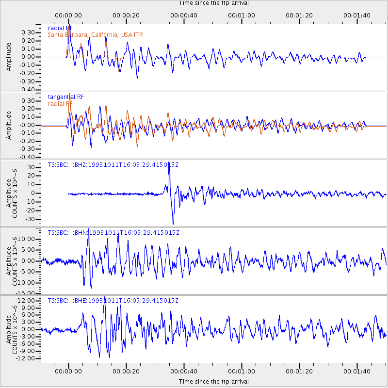
Signal To Noise
| Channel | StoN | STA | LTA |
| TS:SBC: :BHN:19931011T16:05:29.415015Z | 1.4544405 | 9.847207E-7 | 6.7704434E-7 |
| TS:SBC: :BHE:19931011T16:05:29.415015Z | 2.6514816 | 1.5335365E-6 | 5.783697E-7 |
| TS:SBC: :BHZ:19931011T16:05:29.415015Z | 19.241592 | 8.2404895E-6 | 4.282644E-7 |
| Arrivals |
| Ps | 4.8 SECOND |
| PpPs | 13 SECOND |
| PsPs/PpSs | 18 SECOND |


