You are here: Home > Network List > GS - US Geological Survey Networks Stations List
> Station DEC06 Boomer > Earthquake Result Viewer
DEC06 Boomer - Earthquake Result Viewer
*The percent match for this event was below the threshold and hence no stack was calculated.
| Earthquake location: |
Turkmenistan-Iran Border Region |
| Earthquake latitude/longitude: |
37.9/57.3 |
| Earthquake time(UTC): |
2017/05/13 (133) 18:01:01 GMT |
| Earthquake Depth: |
12 km |
| Earthquake Magnitude: |
5.8 Mww |
| Earthquake Catalog/Contributor: |
NEIC PDE/us |
|
| Network: |
GS US Geological Survey Networks |
| Station: |
DEC06 Boomer |
| Lat/Lon: |
39.90 N/88.95 W |
| Elevation: |
215 m |
|
| Distance: |
96.6 deg |
| Az: |
334.488 deg |
| Baz: |
26.306 deg |
| Ray Param: |
$rayparam |
*The percent match for this event was below the threshold and hence was not used in the summary stack. |
|
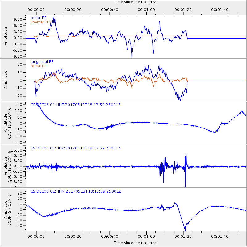
| Radial Match: |
29.908539 % |
| Radial Bump: |
249 |
| Transverse Match: |
80.11943 % |
| Transverse Bump: |
400 |
| SOD ConfigId: |
2028011 |
| Insert Time: |
2017-05-27 18:02:41.871 +0000 |
| GWidth: |
2.5 |
| Max Bumps: |
400 |
| Tol: |
0.001 |
|
Signal To Noise
| Channel | StoN | STA | LTA |
| GS:DEC06:01:HHZ:20170513T18:13:59.25001Z | 1.41506 | 8.816212E-7 | 6.230274E-7 |
| GS:DEC06:01:HHN:20170513T18:13:59.25001Z | 1.8852112 | 2.8555642E-5 | 1.5147184E-5 |
| GS:DEC06:01:HHE:20170513T18:13:59.25001Z | 1.1225154 | 5.9590035E-5 | 5.3086165E-5 |
| Arrivals |
| Ps | |
| PpPs | |
| PsPs/PpSs | |


