You are here: Home > Network List > AV - Alaska Volcano Observatory Stations List
> Station PLBL Mt. Peulik Volcano, Alaska > Earthquake Result Viewer
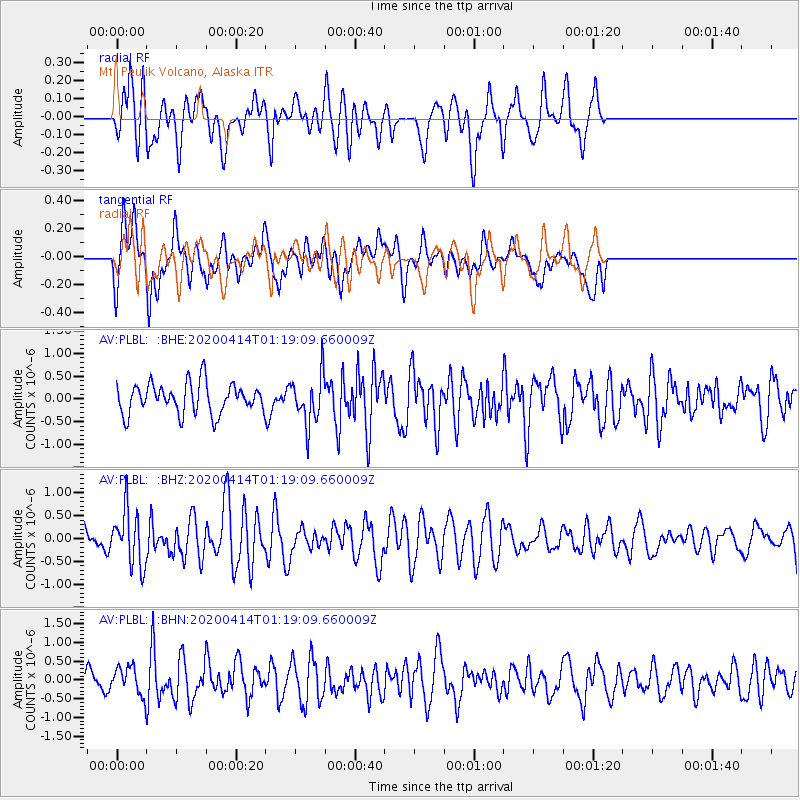
PLBL Mt. Peulik Volcano, Alaska - Earthquake Result Viewer
*The percent match for this event was below the threshold and hence no stack was calculated.
| Earthquake location: |
Kermadec Islands Region |
| Earthquake latitude/longitude: |
-30.4/-176.3 |
| Earthquake time(UTC): |
2020/04/14 (105) 01:06:47 GMT |
| Earthquake Depth: |
31 km |
| Earthquake Magnitude: |
6.0 Mww |
| Earthquake Catalog/Contributor: |
NEIC PDE/us |
|
| Network: |
AV Alaska Volcano Observatory |
| Station: |
PLBL Mt. Peulik Volcano, Alaska |
| Lat/Lon: |
57.70 N/156.82 W |
| Elevation: |
461 m |
|
| Distance: |
89.3 deg |
| Az: |
10.34 deg |
| Baz: |
196.789 deg |
| Ray Param: |
$rayparam |
*The percent match for this event was below the threshold and hence was not used in the summary stack. |
|
| Radial Match: |
61.797634 % |
| Radial Bump: |
400 |
| Transverse Match: |
59.2212 % |
| Transverse Bump: |
400 |
| SOD ConfigId: |
21166931 |
| Insert Time: |
2020-04-28 01:10:15.482 +0000 |
| GWidth: |
2.5 |
| Max Bumps: |
400 |
| Tol: |
0.001 |
|
Signal To Noise
| Channel | StoN | STA | LTA |
| AV:PLBL: :BHZ:20200414T01:19:09.660009Z | 2.6888247 | 5.9765233E-7 | 2.222727E-7 |
| AV:PLBL: :BHN:20200414T01:19:09.660009Z | 0.8301925 | 3.7056807E-7 | 4.4636403E-7 |
| AV:PLBL: :BHE:20200414T01:19:09.660009Z | 1.6101133 | 5.32954E-7 | 3.3100406E-7 |
| Arrivals |
| Ps | |
| PpPs | |
| PsPs/PpSs | |


