You are here: Home > Network List > CI - Caltech Regional Seismic Network Stations List
> Station SMM Simmler, CA, USA > Earthquake Result Viewer
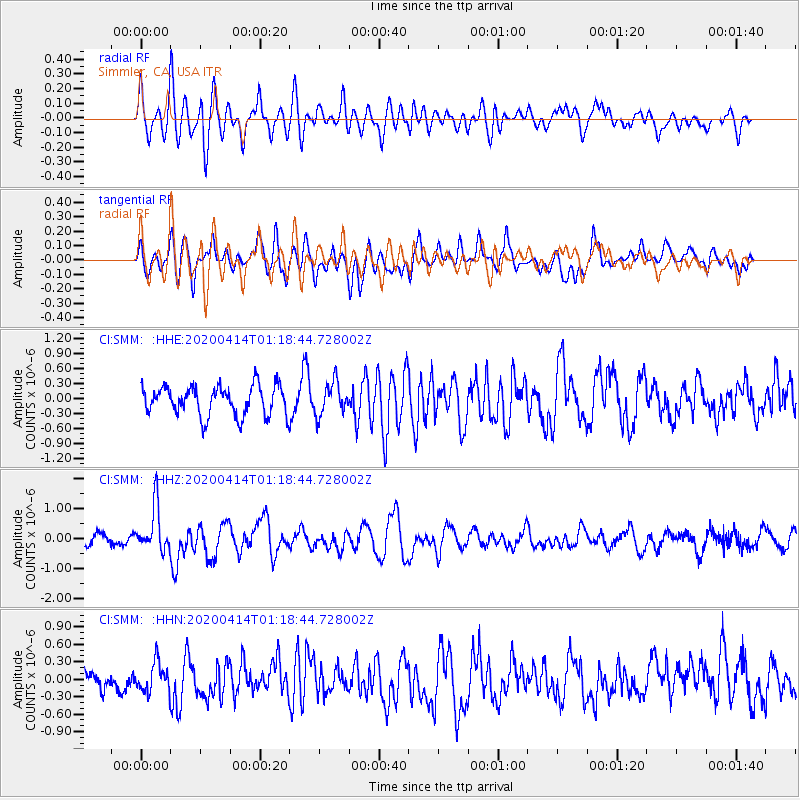
SMM Simmler, CA, USA - Earthquake Result Viewer
*The percent match for this event was below the threshold and hence no stack was calculated.
| Earthquake location: |
Kermadec Islands Region |
| Earthquake latitude/longitude: |
-30.4/-176.3 |
| Earthquake time(UTC): |
2020/04/14 (105) 01:06:47 GMT |
| Earthquake Depth: |
31 km |
| Earthquake Magnitude: |
6.0 Mww |
| Earthquake Catalog/Contributor: |
NEIC PDE/us |
|
| Network: |
CI Caltech Regional Seismic Network |
| Station: |
SMM Simmler, CA, USA |
| Lat/Lon: |
35.31 N/120.00 W |
| Elevation: |
599 m |
|
| Distance: |
84.2 deg |
| Az: |
43.185 deg |
| Baz: |
226.309 deg |
| Ray Param: |
$rayparam |
*The percent match for this event was below the threshold and hence was not used in the summary stack. |
|
| Radial Match: |
72.41409 % |
| Radial Bump: |
400 |
| Transverse Match: |
64.83793 % |
| Transverse Bump: |
400 |
| SOD ConfigId: |
21166931 |
| Insert Time: |
2020-04-28 01:14:48.471 +0000 |
| GWidth: |
2.5 |
| Max Bumps: |
400 |
| Tol: |
0.001 |
|
Signal To Noise
| Channel | StoN | STA | LTA |
| CI:SMM: :HHZ:20200414T01:18:44.728002Z | 3.5058837 | 7.475185E-7 | 2.132183E-7 |
| CI:SMM: :HHN:20200414T01:18:44.728002Z | 1.0489013 | 2.496201E-7 | 2.3798245E-7 |
| CI:SMM: :HHE:20200414T01:18:44.728002Z | 1.1059761 | 3.2360697E-7 | 2.9259851E-7 |
| Arrivals |
| Ps | |
| PpPs | |
| PsPs/PpSs | |


