You are here: Home > Network List > TA - USArray Transportable Network (new EarthScope stations) Stations List
> Station K13K Kusilvak Mountain, AK, USA > Earthquake Result Viewer
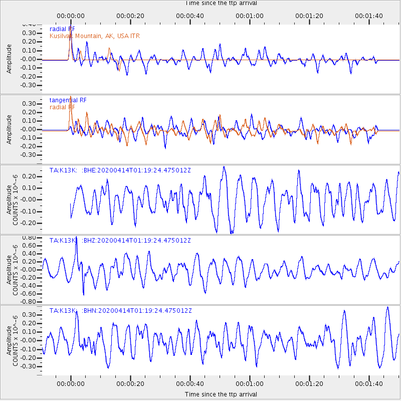
K13K Kusilvak Mountain, AK, USA - Earthquake Result Viewer
*The percent match for this event was below the threshold and hence no stack was calculated.
| Earthquake location: |
Kermadec Islands Region |
| Earthquake latitude/longitude: |
-30.4/-176.3 |
| Earthquake time(UTC): |
2020/04/14 (105) 01:06:47 GMT |
| Earthquake Depth: |
31 km |
| Earthquake Magnitude: |
6.0 Mww |
| Earthquake Catalog/Contributor: |
NEIC PDE/us |
|
| Network: |
TA USArray Transportable Network (new EarthScope stations) |
| Station: |
K13K Kusilvak Mountain, AK, USA |
| Lat/Lon: |
61.93 N/164.66 W |
| Elevation: |
204 m |
|
| Distance: |
92.5 deg |
| Az: |
5.505 deg |
| Baz: |
190.095 deg |
| Ray Param: |
$rayparam |
*The percent match for this event was below the threshold and hence was not used in the summary stack. |
|
| Radial Match: |
68.94075 % |
| Radial Bump: |
400 |
| Transverse Match: |
49.363087 % |
| Transverse Bump: |
400 |
| SOD ConfigId: |
21166931 |
| Insert Time: |
2020-04-28 01:20:54.505 +0000 |
| GWidth: |
2.5 |
| Max Bumps: |
400 |
| Tol: |
0.001 |
|
Signal To Noise
| Channel | StoN | STA | LTA |
| TA:K13K: :BHZ:20200414T01:19:24.475012Z | 2.144768 | 3.2672756E-7 | 1.5233701E-7 |
| TA:K13K: :BHN:20200414T01:19:24.475012Z | 1.7186873 | 1.4924348E-7 | 8.683574E-8 |
| TA:K13K: :BHE:20200414T01:19:24.475012Z | 0.6900554 | 6.389918E-8 | 9.2600075E-8 |
| Arrivals |
| Ps | |
| PpPs | |
| PsPs/PpSs | |


