You are here: Home > Network List > US - United States National Seismic Network Stations List
> Station WUAZ Wupatki, Arizona, USA > Earthquake Result Viewer
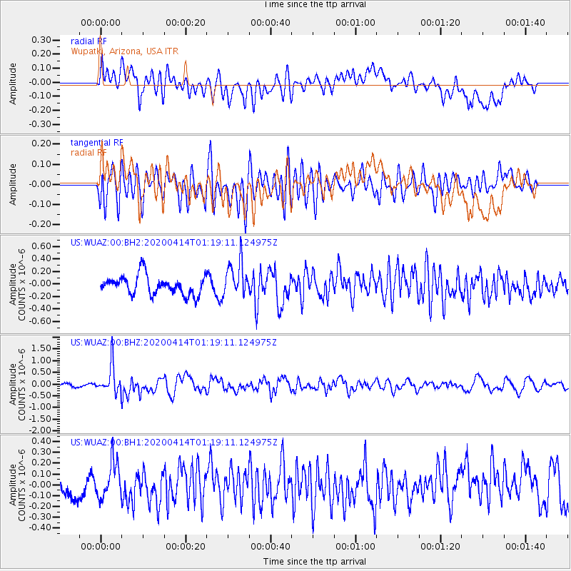
WUAZ Wupatki, Arizona, USA - Earthquake Result Viewer
*The percent match for this event was below the threshold and hence no stack was calculated.
| Earthquake location: |
Kermadec Islands Region |
| Earthquake latitude/longitude: |
-30.4/-176.3 |
| Earthquake time(UTC): |
2020/04/14 (105) 01:06:47 GMT |
| Earthquake Depth: |
31 km |
| Earthquake Magnitude: |
6.0 Mww |
| Earthquake Catalog/Contributor: |
NEIC PDE/us |
|
| Network: |
US United States National Seismic Network |
| Station: |
WUAZ Wupatki, Arizona, USA |
| Lat/Lon: |
35.52 N/111.37 W |
| Elevation: |
1592 m |
|
| Distance: |
89.6 deg |
| Az: |
47.664 deg |
| Baz: |
231.535 deg |
| Ray Param: |
$rayparam |
*The percent match for this event was below the threshold and hence was not used in the summary stack. |
|
| Radial Match: |
53.292168 % |
| Radial Bump: |
400 |
| Transverse Match: |
65.70229 % |
| Transverse Bump: |
400 |
| SOD ConfigId: |
21166931 |
| Insert Time: |
2020-04-28 01:23:48.440 +0000 |
| GWidth: |
2.5 |
| Max Bumps: |
400 |
| Tol: |
0.001 |
|
Signal To Noise
| Channel | StoN | STA | LTA |
| US:WUAZ:00:BHZ:20200414T01:19:11.124975Z | 6.627091 | 6.2135996E-7 | 9.376059E-8 |
| US:WUAZ:00:BH1:20200414T01:19:11.124975Z | 2.2791586 | 1.7650714E-7 | 7.7444E-8 |
| US:WUAZ:00:BH2:20200414T01:19:11.124975Z | 1.8369657 | 2.787476E-7 | 1.5174349E-7 |
| Arrivals |
| Ps | |
| PpPs | |
| PsPs/PpSs | |


