You are here: Home > Network List > WY - Yellowstone Wyoming Seismic Network Stations List
> Station YHH Holmes Hill, YNP, WY, USA > Earthquake Result Viewer
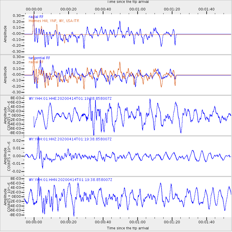
YHH Holmes Hill, YNP, WY, USA - Earthquake Result Viewer
*The percent match for this event was below the threshold and hence no stack was calculated.
| Earthquake location: |
Kermadec Islands Region |
| Earthquake latitude/longitude: |
-30.4/-176.3 |
| Earthquake time(UTC): |
2020/04/14 (105) 01:06:47 GMT |
| Earthquake Depth: |
31 km |
| Earthquake Magnitude: |
6.0 Mww |
| Earthquake Catalog/Contributor: |
NEIC PDE/us |
|
| Network: |
WY Yellowstone Wyoming Seismic Network |
| Station: |
YHH Holmes Hill, YNP, WY, USA |
| Lat/Lon: |
44.79 N/110.85 W |
| Elevation: |
2717 m |
|
| Distance: |
95.6 deg |
| Az: |
40.624 deg |
| Baz: |
232.194 deg |
| Ray Param: |
$rayparam |
*The percent match for this event was below the threshold and hence was not used in the summary stack. |
|
| Radial Match: |
59.657833 % |
| Radial Bump: |
400 |
| Transverse Match: |
62.19341 % |
| Transverse Bump: |
400 |
| SOD ConfigId: |
21166931 |
| Insert Time: |
2020-04-28 01:25:16.297 +0000 |
| GWidth: |
2.5 |
| Max Bumps: |
400 |
| Tol: |
0.001 |
|
Signal To Noise
| Channel | StoN | STA | LTA |
| WY:YHH:01:HHZ:20200414T01:19:38.858007Z | 3.2209904 | 8.860363E-9 | 2.7508196E-9 |
| WY:YHH:01:HHN:20200414T01:19:38.858007Z | 1.5359709 | 3.4227268E-9 | 2.2283797E-9 |
| WY:YHH:01:HHE:20200414T01:19:38.858007Z | 1.5020471 | 3.8069525E-9 | 2.5345095E-9 |
| Arrivals |
| Ps | |
| PpPs | |
| PsPs/PpSs | |


