You are here: Home > Network List > AV - Alaska Volcano Observatory Stations List
> Station SPCR Ckakachatna River, Mount Spurr, Alaska > Earthquake Result Viewer
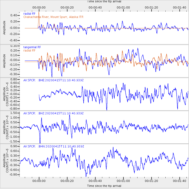
SPCR Ckakachatna River, Mount Spurr, Alaska - Earthquake Result Viewer
*The percent match for this event was below the threshold and hence no stack was calculated.
| Earthquake location: |
Northern Colombia |
| Earthquake latitude/longitude: |
9.0/-74.4 |
| Earthquake time(UTC): |
2020/04/15 (106) 10:59:29 GMT |
| Earthquake Depth: |
53 km |
| Earthquake Magnitude: |
5.7 Mww |
| Earthquake Catalog/Contributor: |
NEIC PDE/us |
|
| Network: |
AV Alaska Volcano Observatory |
| Station: |
SPCR Ckakachatna River, Mount Spurr, Alaska |
| Lat/Lon: |
61.20 N/152.21 W |
| Elevation: |
984 m |
|
| Distance: |
76.2 deg |
| Az: |
330.84 deg |
| Baz: |
96.343 deg |
| Ray Param: |
$rayparam |
*The percent match for this event was below the threshold and hence was not used in the summary stack. |
|
| Radial Match: |
61.591946 % |
| Radial Bump: |
400 |
| Transverse Match: |
50.26324 % |
| Transverse Bump: |
400 |
| SOD ConfigId: |
21166931 |
| Insert Time: |
2020-04-29 11:04:24.155 +0000 |
| GWidth: |
2.5 |
| Max Bumps: |
400 |
| Tol: |
0.001 |
|
Signal To Noise
| Channel | StoN | STA | LTA |
| AV:SPCR: :BHZ:20200415T11:10:40.939Z | 4.6383505 | 5.502286E-7 | 1.1862592E-7 |
| AV:SPCR: :BHN:20200415T11:10:40.939Z | 1.138632 | 2.4019175E-7 | 2.1094765E-7 |
| AV:SPCR: :BHE:20200415T11:10:40.939Z | 1.5526874 | 2.0862598E-7 | 1.3436444E-7 |
| Arrivals |
| Ps | |
| PpPs | |
| PsPs/PpSs | |


