You are here: Home > Network List > US - United States National Seismic Network Stations List
> Station ACSO Alum Creek State Park, Ohio, USA > Earthquake Result Viewer
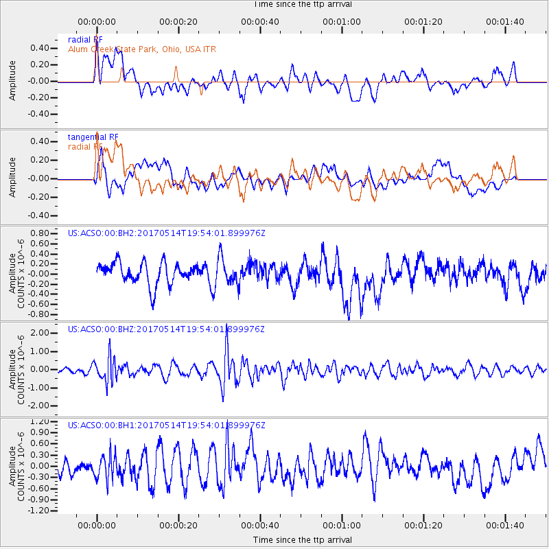
ACSO Alum Creek State Park, Ohio, USA - Earthquake Result Viewer
*The percent match for this event was below the threshold and hence no stack was calculated.
| Earthquake location: |
Chile-Bolivia Border Region |
| Earthquake latitude/longitude: |
-20.9/-68.7 |
| Earthquake time(UTC): |
2017/05/14 (134) 19:44:23 GMT |
| Earthquake Depth: |
124 km |
| Earthquake Magnitude: |
5.6 Mww |
| Earthquake Catalog/Contributor: |
NEIC PDE/us |
|
| Network: |
US United States National Seismic Network |
| Station: |
ACSO Alum Creek State Park, Ohio, USA |
| Lat/Lon: |
40.23 N/82.98 W |
| Elevation: |
288 m |
|
| Distance: |
62.3 deg |
| Az: |
347.711 deg |
| Baz: |
164.936 deg |
| Ray Param: |
$rayparam |
*The percent match for this event was below the threshold and hence was not used in the summary stack. |
|
| Radial Match: |
44.890415 % |
| Radial Bump: |
400 |
| Transverse Match: |
51.936398 % |
| Transverse Bump: |
400 |
| SOD ConfigId: |
2028011 |
| Insert Time: |
2017-05-28 19:59:05.425 +0000 |
| GWidth: |
2.5 |
| Max Bumps: |
400 |
| Tol: |
0.001 |
|
Signal To Noise
| Channel | StoN | STA | LTA |
| US:ACSO:00:BHZ:20170514T19:54:01.899976Z | 3.2346172 | 6.7206275E-7 | 2.0777196E-7 |
| US:ACSO:00:BH1:20170514T19:54:01.899976Z | 1.291326 | 3.2266811E-7 | 2.4987347E-7 |
| US:ACSO:00:BH2:20170514T19:54:01.899976Z | 1.2572739 | 2.678011E-7 | 2.1300141E-7 |
| Arrivals |
| Ps | |
| PpPs | |
| PsPs/PpSs | |


