You are here: Home > Network List > CI - Caltech Regional Seismic Network Stations List
> Station MPP McPhearson Peak > Earthquake Result Viewer
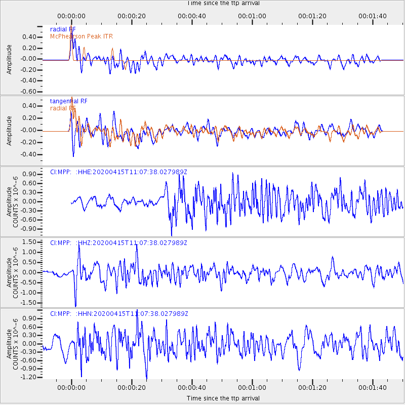
MPP McPhearson Peak - Earthquake Result Viewer
*The percent match for this event was below the threshold and hence no stack was calculated.
| Earthquake location: |
Northern Colombia |
| Earthquake latitude/longitude: |
9.0/-74.4 |
| Earthquake time(UTC): |
2020/04/15 (106) 10:59:29 GMT |
| Earthquake Depth: |
53 km |
| Earthquake Magnitude: |
5.7 Mww |
| Earthquake Catalog/Contributor: |
NEIC PDE/us |
|
| Network: |
CI Caltech Regional Seismic Network |
| Station: |
MPP McPhearson Peak |
| Lat/Lon: |
34.89 N/119.81 W |
| Elevation: |
1739 m |
|
| Distance: |
48.8 deg |
| Az: |
308.902 deg |
| Baz: |
110.765 deg |
| Ray Param: |
$rayparam |
*The percent match for this event was below the threshold and hence was not used in the summary stack. |
|
| Radial Match: |
64.78982 % |
| Radial Bump: |
400 |
| Transverse Match: |
62.984676 % |
| Transverse Bump: |
400 |
| SOD ConfigId: |
21166931 |
| Insert Time: |
2020-04-29 11:08:23.268 +0000 |
| GWidth: |
2.5 |
| Max Bumps: |
400 |
| Tol: |
0.001 |
|
Signal To Noise
| Channel | StoN | STA | LTA |
| CI:MPP: :HHZ:20200415T11:07:38.027989Z | 5.413966 | 6.3237286E-7 | 1.16803996E-7 |
| CI:MPP: :HHN:20200415T11:07:38.027989Z | 2.3746 | 3.8065699E-7 | 1.6030364E-7 |
| CI:MPP: :HHE:20200415T11:07:38.027989Z | 3.509954 | 4.3826535E-7 | 1.2486356E-7 |
| Arrivals |
| Ps | |
| PpPs | |
| PsPs/PpSs | |


