You are here: Home > Network List > CN - Canadian National Seismograph Network Stations List
> Station INK INUVIK, NT > Earthquake Result Viewer
INK INUVIK, NT - Earthquake Result Viewer
*The percent match for this event was below the threshold and hence no stack was calculated.
| Earthquake location: |
Northern Colombia |
| Earthquake latitude/longitude: |
9.0/-74.4 |
| Earthquake time(UTC): |
2020/04/15 (106) 10:59:29 GMT |
| Earthquake Depth: |
53 km |
| Earthquake Magnitude: |
5.7 Mww |
| Earthquake Catalog/Contributor: |
NEIC PDE/us |
|
| Network: |
CN Canadian National Seismograph Network |
| Station: |
INK INUVIK, NT |
| Lat/Lon: |
68.31 N/133.53 W |
| Elevation: |
44 m |
|
| Distance: |
70.5 deg |
| Az: |
340.221 deg |
| Baz: |
115.975 deg |
| Ray Param: |
$rayparam |
*The percent match for this event was below the threshold and hence was not used in the summary stack. |
|
| Radial Match: |
68.211464 % |
| Radial Bump: |
400 |
| Transverse Match: |
48.238434 % |
| Transverse Bump: |
400 |
| SOD ConfigId: |
21166931 |
| Insert Time: |
2020-04-29 11:10:00.495 +0000 |
| GWidth: |
2.5 |
| Max Bumps: |
400 |
| Tol: |
0.001 |
|
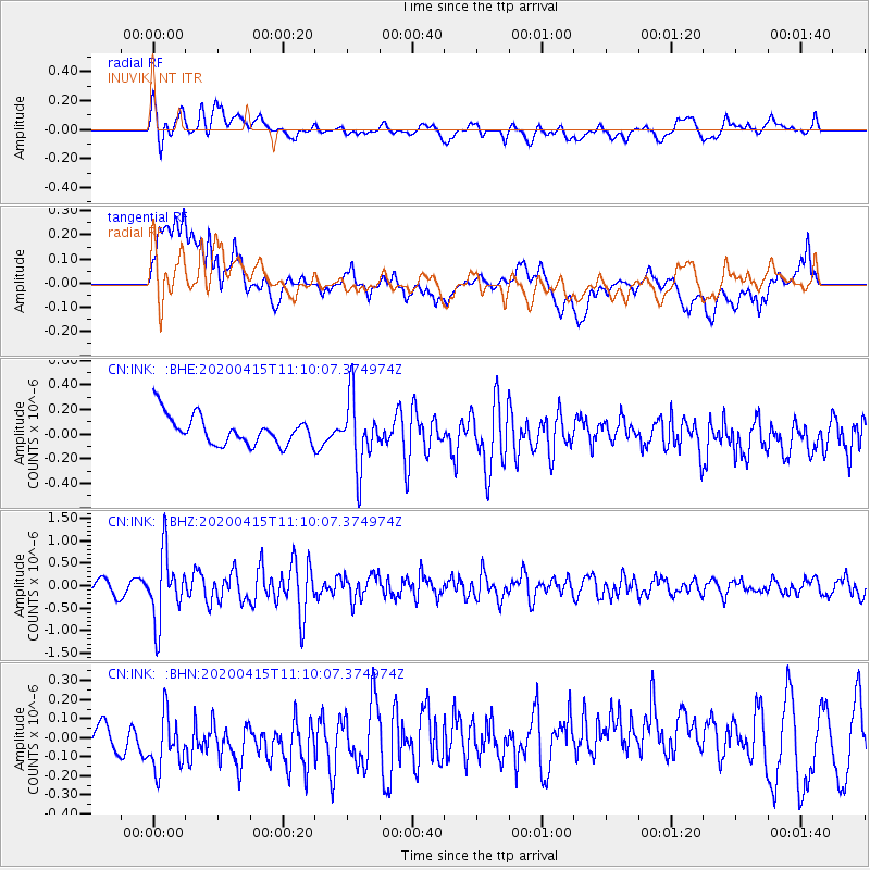
Signal To Noise
| Channel | StoN | STA | LTA |
| CN:INK: :BHZ:20200415T11:10:07.374974Z | 4.7686048 | 7.5089525E-7 | 1.5746645E-7 |
| CN:INK: :BHN:20200415T11:10:07.374974Z | 1.7294346 | 2.519905E-7 | 1.4570688E-7 |
| CN:INK: :BHE:20200415T11:10:07.374974Z | 2.3806205 | 2.7743087E-7 | 1.1653721E-7 |
| Arrivals |
| Ps | |
| PpPs | |
| PsPs/PpSs | |


